|
G3VGR
|
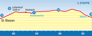
SCHLUCHTENSTEIG Sankt Blasien - Todtmoos
|
 It was raining steadily and also quite foggy when I woke up. Sadly, the forecast was that the rain would persist for most of the day.
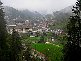
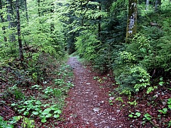
I passed the Dom one last time as I made my way up a narrow path into the forest. The views back to Sankt Blasien were not so good due to the lack of visibility.
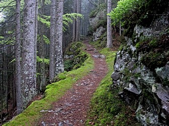
When it's raining hard, I find it's always best to be walking in the woods.
Apart from providing some shelter, the vegetation looks better when wet and the smells are refreshing.
My Goretex lined boots and new Paclite waterproofs ensured I was completely dry and comfortable.
The path through the woods reached the summit of the Lehenskopf where a large wooden lookout tower had been erected.
Due to the poor visibility, the view from the top of the tower wasn't good. I progressed to the end of the forest then crossed a tarmac road into a large field where I could hear cowbells in the fog.
A lack of signs (first experience of this) and poor visibilty meant wasting 20 minutes circumnavigating the field until I found the trail again.
It was raining steadily and also quite foggy when I woke up. Sadly, the forecast was that the rain would persist for most of the day.
I passed the Dom one last time as I made my way up a narrow path into the forest. The views back to Sankt Blasien were not so good due to the lack of visibility.
When it's raining hard, I find it's always best to be walking in the woods.
Apart from providing some shelter, the vegetation looks better when wet and the smells are refreshing.
My Goretex lined boots and new Paclite waterproofs ensured I was completely dry and comfortable.
The path through the woods reached the summit of the Lehenskopf where a large wooden lookout tower had been erected.
Due to the poor visibility, the view from the top of the tower wasn't good. I progressed to the end of the forest then crossed a tarmac road into a large field where I could hear cowbells in the fog.
A lack of signs (first experience of this) and poor visibilty meant wasting 20 minutes circumnavigating the field until I found the trail again.
The trail led me down to a viewpoint, Aussichtspunkt Horbach, where a bronze relief showed all the peaks of the Swiss Alps that were visible from here.
Unfortunately, the fog ensured I couldn't even see as far as the next field, let alone the next country.
I proceeded downhill to Klosterweiher where in a picturesque location, a restaurant was located next to a pond.
My morning's run of bad luck continues as a sign indicated the restaurant wasn't scheduled to open for the season until next Saturday, so I was unable to get a hot drink and instead, carried on up into the woods past some remnants of old nickel works.
I took a break at the Kreuzfelsenhütte overlooking Ibach, which also had a viewpoint with a bronze plaque showing all the Swiss Alpine peaks visible from here on a clear day.
At the end of the woods, I was now in more open countryside, much like moorland. This was an interesting change of habitat. It was a pity the weather was too poor to enable me to appreciate it fully.
After continuing downhill, I reached an exposed bare hill surmounted by a large cross. This imposing site is known locally as "Aussichtspunkt Lampenschweine", and I made my way through the wind and driving rain up to the Gipfelkreuz.
Despite the poor visibility an impressive panorama over the Hotzenwald was visible from the hill.
Heading back to the trail, I saw two girls braving the weather to hike the Schluchtensteig. I did remember seeing them yesterday, enjoying the sunshine at Unterkrummelhof. However, like me, they were looking very bedraggled today.
The trail continued across some meadows, through another wood then along a tarmac road. It was very exposed here and the wind was now driving the rain horizontally at me.
I saw a bus stop and the timetable showed a bus to Todtmoos was due in three minutes. Although I was tempted, I opted for the long uphill walk to some more woods instead as it was only another 4Km to Todtmoos.
There was snow on the ground when I reached the woods and I was beginning to feel quite sorry for myself by now.
At the end of the woods was another impressive large cross, the Ibacher Kreuz, built in 1777 on the site of a former chapel.
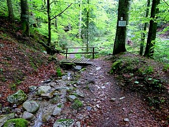
Crossing the main road, the trail continued down the Hohwehraschlucht to Todtmoos. The Hohwehraschlucht finished at the beginning of the Hauptstrasse of Todtmoos.
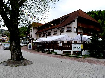
Conveniently, a butcher's shop was also located there and it had now ceased raining. After taking off my waterproofs, I sat outside the shop enjoying a hot coffee and rindswurst.
From here it was a 20 metre walk to the Hotel Schwärzwalderhof, my stop for the night.
View back to Sankt Blasien
|
Albert Weisenberger Weg
|
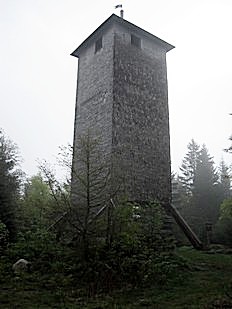
Lehenkopfturm
|
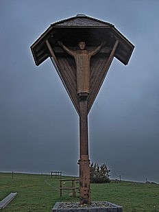
Gipfel Kreutz
|

You can see the Swiss Alps from here...
|
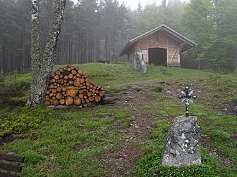
Kreuzfelsenhütte
|
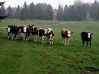
Friendly citizens of Oberibach
|
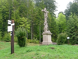
Ibacher Kreutz
|

Rastbank Waldflurbereinigung
|
Wehratal
|
Hohwehrschlucht
|

Hohwehrschlucht
|
Hotel Schwarzwälderhof
|
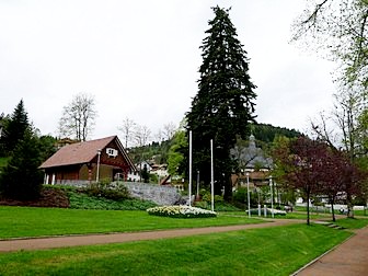
Todtmoos Kurpark
|