|
G3VGR
|
NECKARSTEIG Neckargerach - Lindach
|
 After spending time studying GoogleMap's satellite view of Neunkirchen and reading the town's website, I was unable to see any worthwhile reason to visit the place.
Also, the transport connections to Neunkirchen are infrequent and I didn't wish to spend 2-3 hours hanging around there waiting for the bus.
As the Neckarsteig does not include Schloss Zwingenberg and the Wolfschlucht, I reasoned my walking time could be better spent by modifying my route to include these two highlights as an alternative to the last 4Km stretch to Neunkirchen.
The weather was dull, but dry and humid as I caught the train from Mosbach to Neckargerach.
From Neckargerach I could already see the ruins of Burg Minneburg on the opposite bank of the Neckar.
After crossing over the big road bridge to Guttenbach, I made my first change to the route.
The trail goes in a large loop around the Mittelberg, ending back not far from the start.
This doesn't really seem to add anything useful to the Neckarsteig experience, so I decided to take the direct route to Burg Minneburg instead, which was on a steep path up through the forest.
After spending time studying GoogleMap's satellite view of Neunkirchen and reading the town's website, I was unable to see any worthwhile reason to visit the place.
Also, the transport connections to Neunkirchen are infrequent and I didn't wish to spend 2-3 hours hanging around there waiting for the bus.
As the Neckarsteig does not include Schloss Zwingenberg and the Wolfschlucht, I reasoned my walking time could be better spent by modifying my route to include these two highlights as an alternative to the last 4Km stretch to Neunkirchen.
The weather was dull, but dry and humid as I caught the train from Mosbach to Neckargerach.
From Neckargerach I could already see the ruins of Burg Minneburg on the opposite bank of the Neckar.
After crossing over the big road bridge to Guttenbach, I made my first change to the route.
The trail goes in a large loop around the Mittelberg, ending back not far from the start.
This doesn't really seem to add anything useful to the Neckarsteig experience, so I decided to take the direct route to Burg Minneburg instead, which was on a steep path up through the forest.
The castle ruins are very impressive. There was nobody else about, so I was able to appreciate it all in silence.
There were good views of the Neckar from here.
I rejoined the official Neckarsteig trail, which proceeded pleasantly along the Brunnenweg, a flat forest road, towards Neunkirchen.
After a few kilometres, I reached the Kellersbrunnen Hütte and turned right to make my way towards Zwingenberg.
There were no signs on this path, which followed the perimeter of the protected Zwerrenberg Nature Reserve, so I had to rely on my own navigation.
After a few more kilometres along this trail, it appeared it would lead further west of my objective than necessary, so I decided to bushwhack my way down through the forest to get to Zwingenberg.
Although the descent was very steep, it wasn't difficult progress and most of the hillside was covered in moss and ferns which was a fine sight.
I crossed two more forestry roads during my descent and was amazed at my previously unrevealed navigational skills when I arrived exactly opposite and above the new bridge at Zwingenberg.
With a little dexterity, I was able to make it onto the bridge and crossed over to the town.
There is very little in Zwingenberg, but it is in a nice setting on a bend of the Neckar.
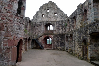
The town is overlooked by the impressive Schloss Zwingenberg.
After coffee in one of the few restaurants in town, I made my way up a steep path to the west side of the castle.
At the back of the castle is the start of the Wolfschlucht. Again, I was able to enjoy this ravine in complete silence as I had yet to see another walker this day.
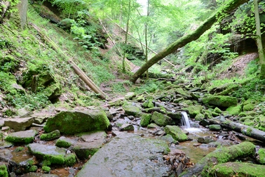
Unlike the Margarethenschlucht, much of the path actually leads through the tumbling water, so one is moving gingerly on slippery rocks instead of sliding around in slippery mud.
The foliage in the ravine is spectacular and I spent much time admiring it's beauty.
Just before reaching the top, disaster struck when I stepped onto a large flat rock. Suddenly and without warning, both feet slipped back and I fell face first onto the rock.
I had no time to break my fall with my hands and my face took the full force of the fall. Luckily my head narrowly missed a jagged rock as I fell.
I think I was unconscious for a short time and just laid in pain on the rock in the running water for quite a while whilst using my tongue to examine if I still had all my teeth.
My right leg was badly cut and grazed. I had no mirror to examine my face, but later found my jaw was heavily bruised and my lower lip was quite swollen.
I felt quite shaken by this accident, but luckily no serious damage was done. After applying some first aid and a couple of medicinal shots of Obstler, I carried on to the top of the ravine.
When I reached the top, there were no signs whatsoever. I had the choice of going left or right. It was just as well that I had brought a detailed map with me today.
After some studying, calculation and guesswork, I decided to go left and make my way towards Lindach.
I spent the next few miles on more forestry roads, using map & GPS to navigate.
The forest was deserted and I stopped at a pile of logs and made lunch.
Following the paths downhill, I eventually reached the village of Lindach and found the bahnhof.
My luck with synchronizing my walks with train times had still deserted me as I arrived on a platform just in time to watch the hourly train to Mosbach arrive and depart from the opposite platform.
Lindach has no shops, bars, restaurants, night clubs or museums. It does have a fire station and a very old rathaus though.
After thoroughly exploring the village in less than 10 minutes, I was glad I'd packed my iPod and sat on the station bench listening to Schumann until the next train eventually arrived.
The Frühlingsfest was still in full swing when i got back to Mosbach. I was now finding the fair very tedious and avoided the centre, eating at the Greek restaurant under the hotel instead.
My bruised and battered face attracted some odd looks from fellow diners.

Neckarbrücke at Neckargerach
|
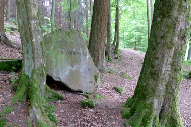
This way to Burg Minneburg
|
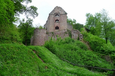
Burg Minneburg
|
Burg Minneburg
|
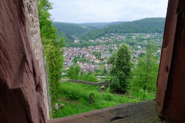
View to Neckargerach from Minneburg
|
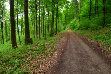
Along the Brunnenweg
|
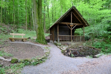
Kellersbrunnen Hütte
|
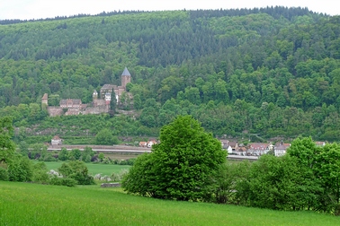
Zwingenberg and Schloss Zwingenberg
|

The new Zwingenberg bridge
|
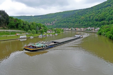
View downstream from Zwingenberg bridge
|

Path to Schloss Zwingenberg
|

Schloss Zwingenberg
|
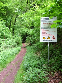
Entrance to Wolfschlucht
|

Not just a casual stroll
|
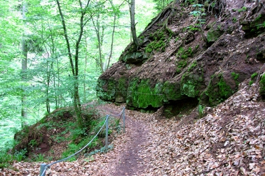
Through the Wolfschlucht
|

Through the Wolfschlucht
|

Through the Wolfschlucht
|
Through the Wolfschlucht
|
[Home]