


GB0HI

Location 53.23 North 03.13.7 West
LOCATOR IO83KF
IOTA EU-120
WAB SJ18
WAZ 14
ITU 27

Operators
Tony/G0VBD
Terry/G0WAB
John/G4WXO
Len/M0BOS
Equipment - Transceivers
Icom 736
Yaesu FT990
Yaesu FT767GX
Yaesu FL7000 Linear
Antenna's
3-Element 10-15-20mtrs 'TET' Tribander Beam
2-Element 10mtr MonoBand Beam
40-80mtr Double Dipole
20mtr Complete Loop
20mtr Duplet Dipole
15mtr Inverted 'V' Dipole
 Main Station SSB
 Second Station CW/SSB


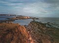
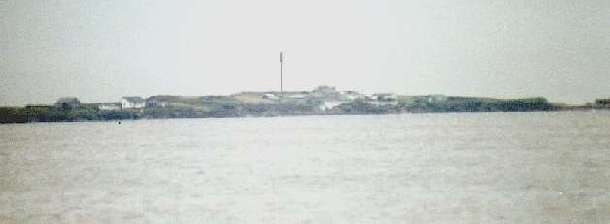
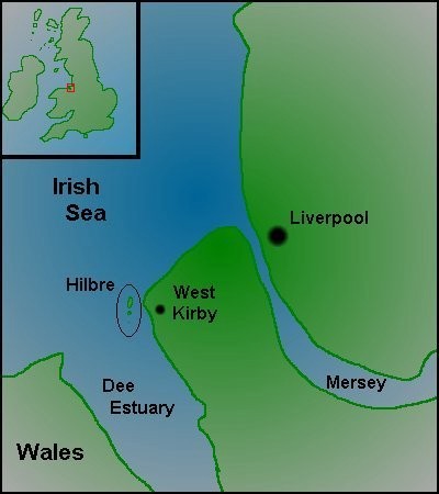
Hilbre is a small island nature reserve and site of special scientific interest (an SSSI). It lies about a mile off the coast of England in the estuary of the River Dee.
General Information
In the estuary of the River Dee are three tidal
islands situated along a line of bunter sandstone that runs roughly parallel
to the shore.
Further evidence of this ridge can be seen in two shoals - The Tanskies and
The Clady Blacks,
which are both covered at high tide.
 Hilbre is the largest (11 acres) and most northerly of the islands.
Little Hilbre (or Middle Eye)
is south-east of Hilbre and is smaller and uninhabited.
The Little Eye is much further south-east and less than half an acre is
left exposed on the
high water of spring tides. During the winter months this tiny islet is
famous as a high tide
roost for large numbers of wading birds. The birds are best seen from the
mainland, as the
presence of people will discourage them from landing.
 Although made up of three seperate islands, maps of the area made between
1577 and 1648 all show
Hilbre as a single island roughly square with a deep inlet in the south-west
corner. Hilbre,
itself, is about 11.5 acres, Little Hilbre about 3 acres and The Eye about
0.5 acres.
Although made up of three seperate islands, maps of the area made between
1577 and 1648 all show
Hilbre as a single island roughly square with a deep inlet in the south-west
corner. Hilbre,
itself, is about 11.5 acres, Little Hilbre about 3 acres and The Eye about
0.5 acres.
The name is derived from the Old English Hildeburgh and Eg meaning
Hildburgh's Island and is
thought to have been a place of pilgrimage from saxon times.
 The tide surrounds the islands at approximately three hours before local
high water, isolating
them from the mainland for five hours in every twelve.
The tide surrounds the islands at approximately three hours before local
high water, isolating
them from the mainland for five hours in every twelve.
From Tudor times, both Hilbre and Hoyle Lake were used as an anchorage
by the small ships
that traded with Ireland from the Port of Chester. The Mersey Docks and
Harbour Board bought
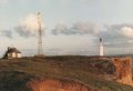
Hilbre in 1856, having previously erected a telegraph station and an
automatic tidal-gauge.
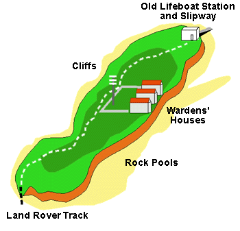
 The Lifeboat Station was erected in 1849 at a cost of 1200 UK Pounds. It was
built as an
alternative deep-water station for when the Hoylake Lifeboat was unable to
launch at low-tide.
The Lifeboat Station was erected in 1849 at a cost of 1200 UK Pounds. It was
built as an
alternative deep-water station for when the Hoylake Lifeboat was unable to
launch at low-tide.
The station was manned by the Hoylake crew who were summoned by the
firing of one of a pair
of cannons, which were replaced in 1890 by rockets.
In 1945 the Hoylake Urban District Council bought the island for 2500 UK
Pounds for the use
of the general public, and as a bird sanctuary.
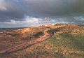
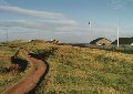
What and Where is Hilbre?
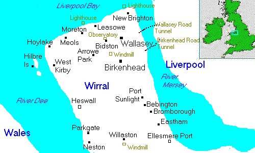
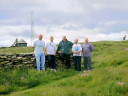
Hilbre is a small island in the estuary of the River Dee, between the Wirral and North Wales. Because of it's great importance to many importance to many species of bird (as a place to over- winter or a place to rest during long migrations) the island is protected as a nature reserve. More recently it has been declared a Site of Special Scientific Interest (SSSI). The island is maintained, and rules enforced, by the Warden (Dave) and a team of people in yellow shirts with red shorts. The name of this team keeps changing - it used to be the "Beach Patrol", but I think they now call themselves "Lifeguards". Anyway, they're the people in charge.
 Although I tend to refer only to the island of Hilbre, the nature reserve
actually consists of
all three islands in the group. The maps show the location of the islands,
but please note that
the islands are actually a lot smaller than the maps suggest, if I had them
to scale they'd be
virtually invisible.
Although I tend to refer only to the island of Hilbre, the nature reserve
actually consists of
all three islands in the group. The maps show the location of the islands,
but please note that
the islands are actually a lot smaller than the maps suggest, if I had them
to scale they'd be
virtually invisible.
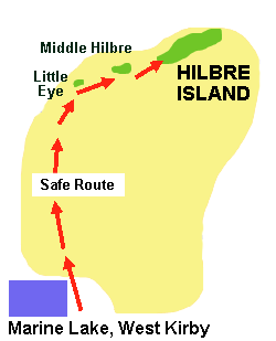
Access is from the town of West Kirby. Getting onto the estuary is easiest via the slipway at the end of Dee Lane (next to the marine lake). The crossing can be made at low-tide when the water recedes and passage by foot is made possible. Being a nature reserve, access to the islands must be controlled. This means that a permit is required for a visit. Permits are available free of charge, but a maximum of fifty people are allowed on the island at a time so it is a good idea to think ahead and book in advance. When planning a visit to Hilbre it is very important to check the tides so that you don't get stranded half way across. Tide times are posted on the notice board at the Dee Lane slipway.
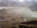
How We Approach and Land On Hilbre
"This image is used with the permission of www.davidnulty.org.uk"
"This image is used with the permission of www.davidnulty.org.uk"
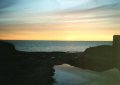
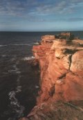
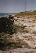
More Pictures of Hilbre