This content of this page contains a mixture of Amateur Radio related topics such as Amateur Radio High Altitude Balloons, Aircraft scatter propagation (ACS), RADAR and Virtual Radar (using ADS-B) together with other sections about Military aircraft and aircraft tracking/spotting in general.
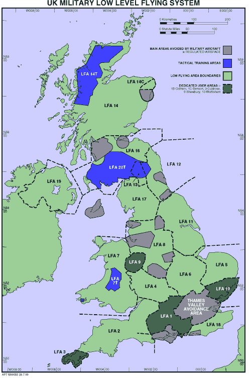
I have a personal interest observing Military aircraft in flight and this page also reflects that and provides a number of useful links to other related sites. I am particularly interested in military helicopters, as well as experimental, unusual or exotic aircraft. Living in the Lake District National Park with its many mountains and valleys, provides me with an abundance of jets, helicopters and other aircraft, flying at low level, to and from RAF Spadeadam an electronic warfare range to see.
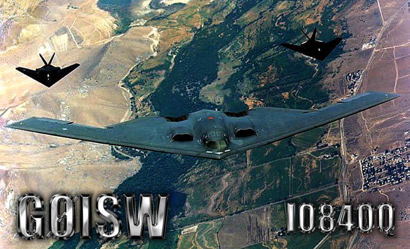
My old amateur radio QSL card design, showing my interest in stealth aircraft.
Virtual Radar ADS-B
First, the good news. You do not need to buy any equipment to track and follow military aircraft as there are now an abundance of online sites displaying the real-time flights shared from the live feeds of those like myself who have bought ADS-B equipment.
The good news is if you do decide to buy your own ADS-B equipment it can cost you as little as £6. That £6 is the cheapest price I paid for a USB ADS-B dongle and antenna in 2019, but you can spend a lot more if you really want to as you will see below. However prices have come down a lot in the past 5 years and now for a budget of under £50 you can have a really good top quality receiver and aerial.
To watch for free I would recommend the following website http://globe.adsbexchange.com The screen will be populated initially will all Civilian and Military flights displayed and can seem hugely crowded, simply click on the 'U' button on the top right of your PC display and that will filter out everything except the military aircraft.
2014
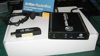
I took advantage of a special discounted offer from Moonraker for an AirNav Radarbox 3-D ADS-B receiver system in order to track in real-time aircraft transmitting their positions on 1090 MHz within approximately a maximum range of 217 miles (350 km) from my home location. The previous usual £500 price back then having been reduced to only £99.
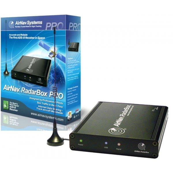
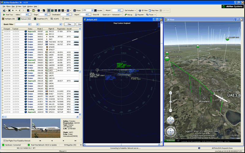
This was my very first ADS-B system and I setup alerts for specific aircraft or types of aircraft I was interested in. The system automatically recorded and logged all aircraft received and downloads pictures from the Internet of them too, for later review.
2015
The best distance I achieved initially, using the very basic aerial supplied with the ADS-B for aircraft reception, was 195 miles (313 km) on Monday 2nd November 2015 from an Air France flight near Heathrow airport. Conditions at the time had been very foggy overnight so possible tropo signal enhancement may have helped. I may have received signals from much further out from higher altitude U-2S military reconnaissance aircraft at 60,000 feet or higher, but will never know for certain as they do not transmit their precise location for security reasons.
Since then I had replaced the basic antenna with a higher gain 5dB antenna with slightly better results, best distance being 210 miles (338 km) for a Civilian aircraft at 37,000 feet near Oxford, the vast majority of aircraft being detected out to about 190 miles (305 km), mountainous obstructions permitting.
It is worth noting that the ADS-B aircraft transmitter power levels are set by regulation to be a minimum of 75W from small aircraft and 125W from large aircraft. The actual ADS-B transmitters from large aircraft can also be 250W up to a maximum of 500W.
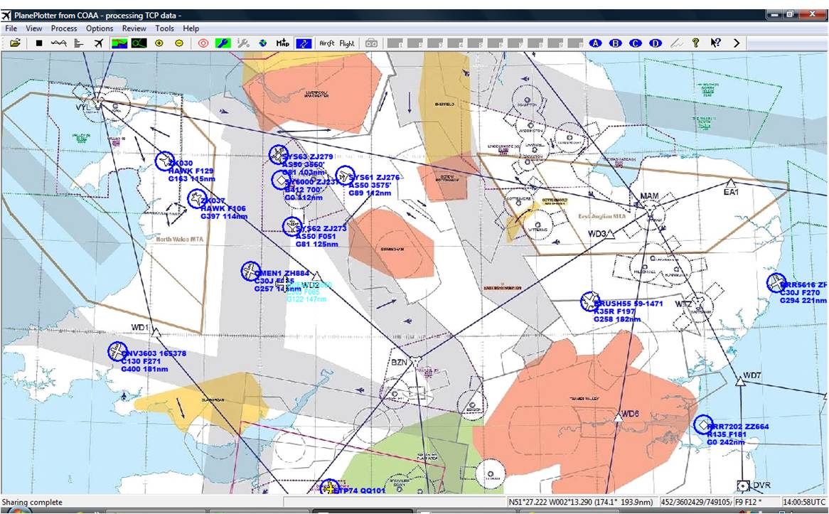
Whilst I was mostly pleased with my AirNav Radarbox (ANRB) 3-D ADS-B receiver, I would then have chosen to buy the Kinetic SBS-3 receiver as that had built in SDR VHF/UHF receivers and could provide upload data for Multilateration Surveillance (MLAT) of Military aircraft for PlanePlotter software, whereas the ANRB cannot. However this fantastic piece of equipment appears to no longer be made.
The price of the SBS-3 was between £475-499 as of October 2015 and every dealer appears to be out of stock.
It is possible however using additional PlanePlotter software to receive MLAT positions of military aircraft, but this requires a modest annual fee unless you are uploading and providing MLAT data yourself as part of the project. I have observed MLAT detection to be very effective over the UK particularly Southern England, but here in the Lake District there are not sufficient MLAT upload stations active for the lower level aircraft. MLAT works at any altitude, but no obstructions such as mountains should be in the line of sight path between the target aircraft transmitting ADS-B and the 3 or more ground stations.
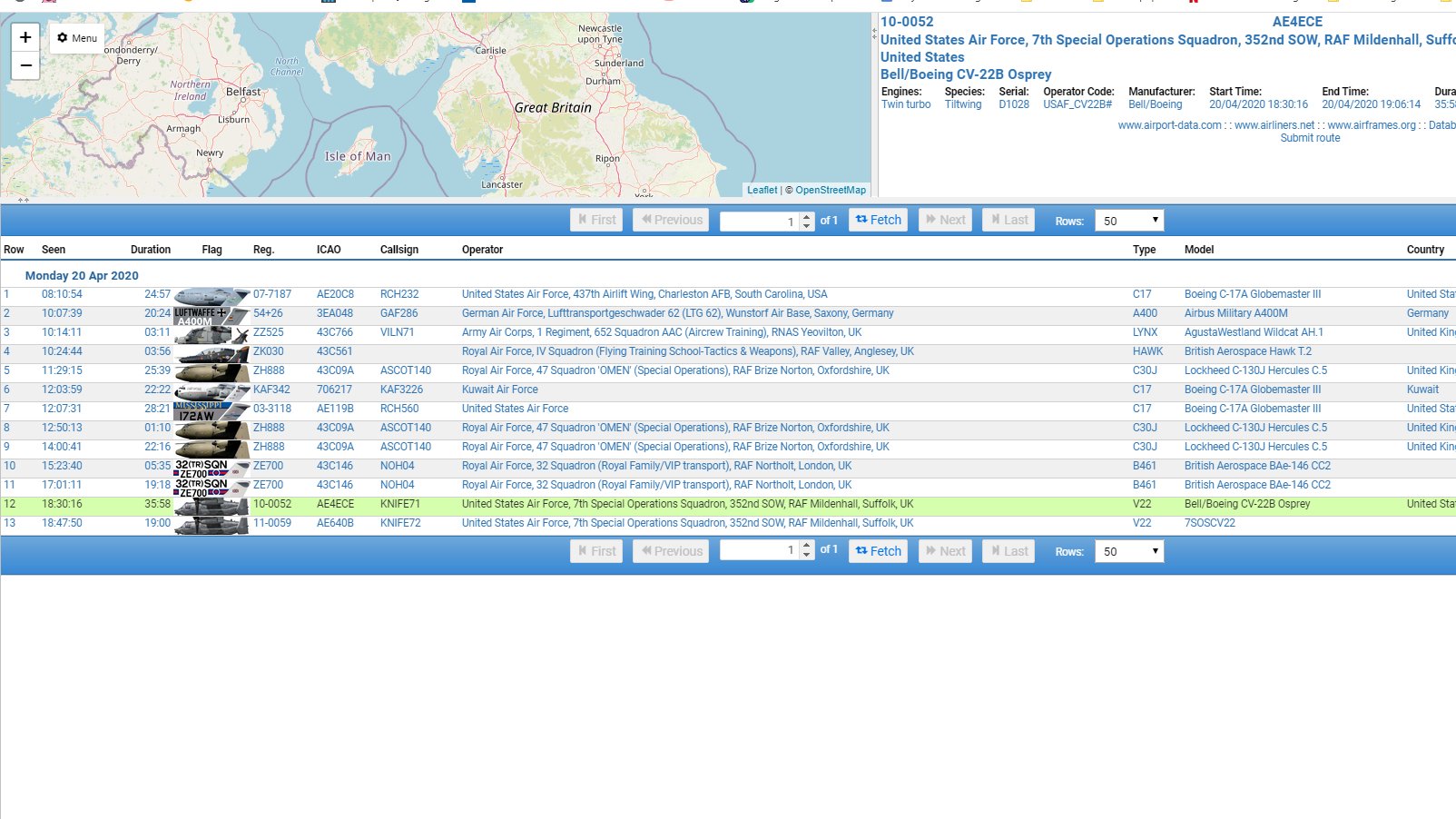
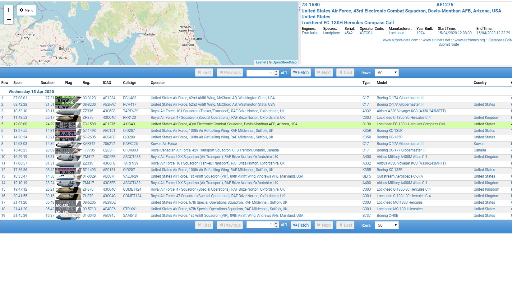
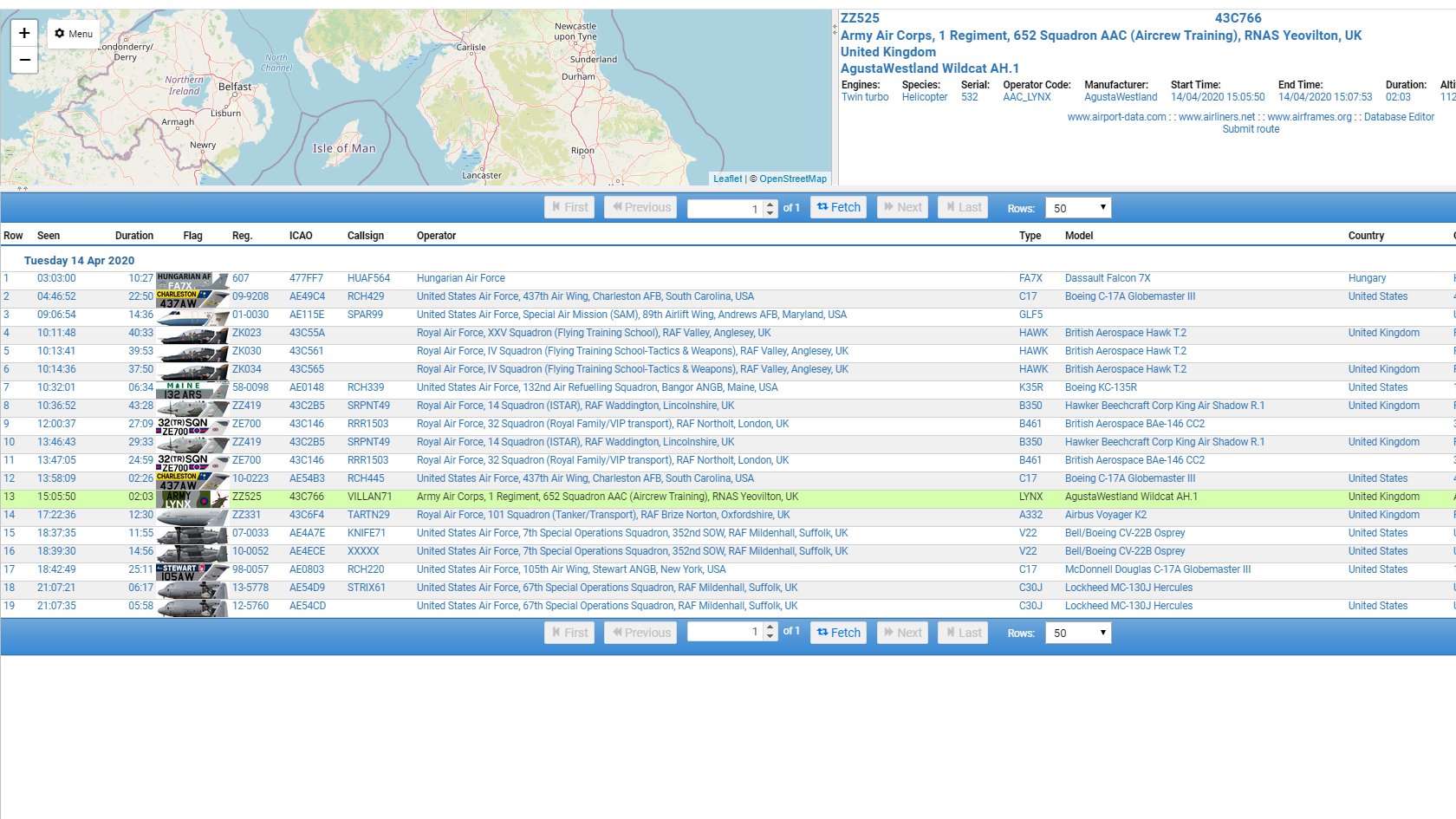
A live map of participating PlanePlotter/MLAT stations can be found here or shown below is a screen shot of my own PlanePlotter MLAT military aircraft tracking using other ground stations and not my own. Remember none of these military aircraft are transmitting their own positions, you can see for each aircraft their callsign, registration, aircraft type, flight level (F), Ground speed (G) and range away from my location. The display map I am using is an unclassified military air corridor map.
In the illustration below are a mixture of British, US and Canadian military Hawk, C130, K35 tankers and AS50 helicopters
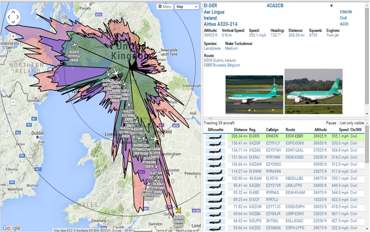
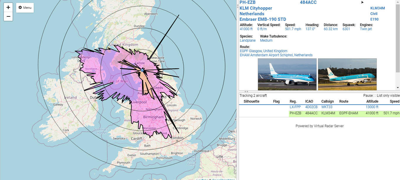
From October 2015 I linked the live output of my own AirNav Radar (ANRB) system to a Virtual Radar Server web based browser, which superimposes the data over a better looking Google Maps screen, see example below. I can also display a much better range plot overlay by altitude, the colours below showing
Yellow: Up to 9,999 feet
Green: 10,000 to 19,999 feet
Blue: 20,000 to 29,999 feet
Red: Above 30,000 feet
Purple: All altitudes
Note that the range plot is far from perfect and not circular with a number of factors causing this, from obstructions to the radio line of sight path caused by nearby mountains, to the aircraft themselves flying in preset narrow air corridors.
Low flying aircraft such as small privately owned propeller driven planes most often do not carry ADSB transmitters, so very little is shown in yellow below 10,000 feet. Air ambulance helicopters and military aircraft at low altitude mostly do not transmit their positions so they do not help to populate the range plots.
The two radar range rings are set at 100 and 200 miles respectively. From my location you would expect to see aircraft near Dublin which has a large busy airport, however the Cumbrian mountains block me in that direction very effectively i.e Helvellyn, Coniston Old Man etc. Similarly Newcastle airport to my East is blocked to me by the Pennines which are very close to me being only 8 miles away.
Setting up my AirNav RadarBox (ANRB) receiver to work with the Virtual Radar Server, was a bit tricky to figure out, however the main points to note within the VRS setup options are:
1. The receiver format should be 'BaseStation'
2. Connection type should be 'Network', 'normal'.
3. No need for merged feeds or rebroadcast servers
4. In addition you need to download a separate 'Basestation.sqb' file (I placed mine within the AirNav data folder and direct the VRS option 'Database filename' to it otherwise you will not see aircraft silhouettes or registrations, which are retrieved only from this database and not from live ADSB data.
5. Download and install the Plugin for VRS called 'Database Writer Plugin' to automatically add your ADSB received aircraft details to this database.
6. Additionally download and install the Plugin for VRS called 'Database Editor Plugin' to manually edit aircraft details within this database.
2017
For free MLAT tracking of military aircraft I now use in 2017 the ADS-B Exchange website, select Global Radar View, which then uses the same VRS display as above and in Menu>Options>Filters> 'Add Military' and 'enable filters', this allows you to display just military aircraft anywhere in the World with ADSB or MLAT coverage.
I am also interested in the JSTARS software to be able to link my live aircraft observations with Twitter and to separate Military from Civilian spots, but at this time the software is unavailable.
2019
On Saturday 28th December 2019 I received an ADS-B position report from an aircraft at 357 km range, flying at an altitude of 41,000 feet South of Oxford, this was using a cheap DAB magnetic aerial designed for 175-230 MHz and not the 1090 MHz band. The aerial being outside on the roof at an angle of approximately 30 degrees, so not ideally mounted. In theory the maximum distance I should be able to achieve in perfect line of sight conditions for commercial aircraft at around 36,000 feet is about 375 km range.
In 2019 my original Airnav Radarbox died and I replaced it initially with the much smaller Airnav Micro Radarbox USB stick for £6 from Amazon.co.uk. Performance has been very similar or better. The price has varied since from £9 to £24.
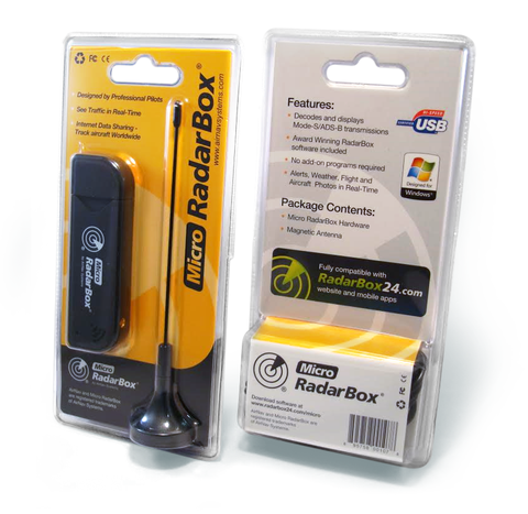
The supplied small 1090 MHz aerial is terminated with a MCX connector on only a very short 1m length of coaxial cable, so I was only been able to use this aerial indoors, but received aircraft up to 100 miles (160 km) away which surprised me. I ordered an MCX to SMA adaptor to allow me to use my 5dB higher gain ADSB aerial outdoors once more. In the picture below you can see the size of the two units for comparison.
My primary interest though remains Military aircraft and whilst they do not always transmit positional data, highlights of what I have detected in real-time from home so far would include:
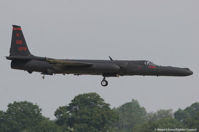
Several USAF U-2S Dragon Lady Special Reconnaissance aircraft flying at 60,000 feet or higher! One was at 72,000 feet, but my ADS-B system restricts maximum displayed heights to 60,000 feet, so I had to use an online lookup.
Many USAF V22 Osprey SOCOM aircraft flying at low level here in the UK close to my home. I know exactly where these are going due to local knowledge and confirmed visual sightings.
_-_RAF_Mildenhall_-_Suffolk,_England_-_26th_Sept._2013.jpg)
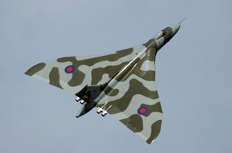
Vulcan Bomber XH558 last flight over Cumbria
https://www.youtube.com/watch?v=d4H_6_tp42Y
Multitudes of C17, C5, C130, Tornado (now retired), Euro-fighter, etc on a daily basis, although the final flight of Tornado's took place in February 2019 and they have been retired from service. I often detect and am alerted, by an audio wav file of a WW2 air raid siren, to fast jets or helicopters at low level just before they then fly over my house!
Basically stations using MLAT can find the positions of aircraft by trigonometry, where 3 or more ground stations distanced sufficiently apart receive the transmitted signal from the host aircraft at the same time.
2020
A significant upgrade to my ADS-B receiving setup has been the installation of a FlightAware ProStick USB ADS-B receiver, with dump1090 software feeding Virtual Radar Server web desktop to provide a visually appealing interface. This ADS-B receiver is also capable of MLAT making it useful for tracking aircraft that are not transmitting their position data.
I feed my MLAT data to Freedar.uk, which is a free web and mobile based browser application that shows live ADS-B flights, both civil and Military, anywhere in the World. You can filter the output to only show you categories you have an interest in.
On the map below you can see my ADS-B receiver range coverage, which is impacted by high surrounding mountains here in the Lake District. Purple denotes all altitudes, orange below 10,000', however as a result of the Covid-19 pandemic there are very few flights at present and this April 2020 map of coverage is not fully complete compared to normal. The three tracks extending into the North Sea are false spurious traces as far as I am aware, unless it was a USAF U-2 when they did sometimes transmit ADS-B.
The FlightAware ProStick I have has a built in 1090 MHz preamplifier and filter and its performance far surpasses anything I have used before. Comparing side by side with my Micro RadarBox has shown the almost double the numbers of aircraft received and my maximum range is nearly the theoretical limit of 375 km for aircraft at 37,000' altitude.
Here are some examples of my Military ADS-B catches received direct at home
2024
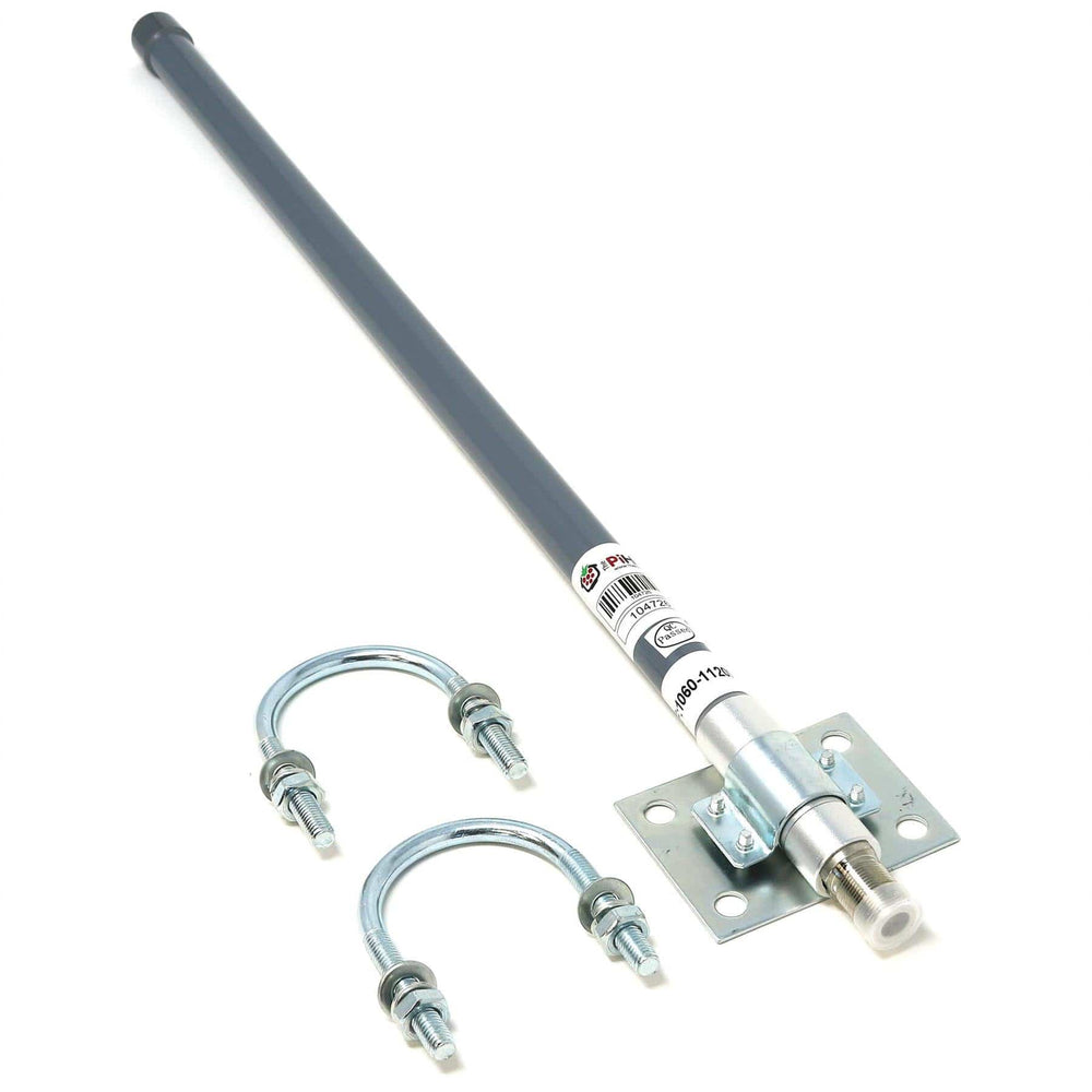
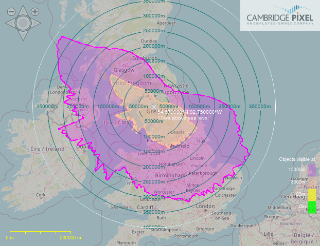
Another upgrade to my ADS-B virtual radar system has been finding the best aerial to use. I have tried several over the years all mounted externally at roof level and have now discovered the best yet, which is a 60cm long 1090 MHz vertical bought from the Pi-Hut for £24 and is actually mounted inside my radio shack, not externally.
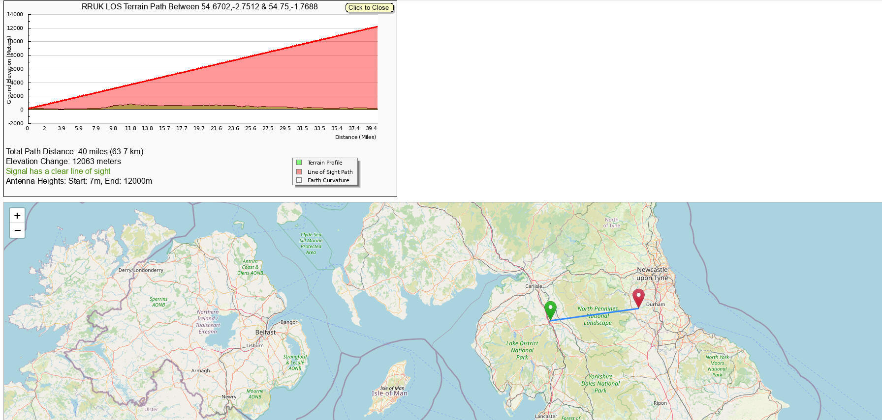
The ADS-B coverage is significantly better as you can see in the image below, taken after a few days of use. The new aerial received coverage map is shown on the left and on the right is the Cambridge Pixel radar Line-of-sight tool prediction, using topographical data. The shapes are broadly similar with purple colouring showing 12,000m (36,000 feet) and orange colouring showing 3,000m (10,000 feet).
Some of the difference seen on the ADS-B plots are due to aircraft not flying in all directions and instead sticking to certain paths/routes, also the aircraft ADS-B transmitters are low powered and that too can affect range. Some of the routes for example to Dublin over the Irish sea are typically flown at much lower altitudes than 36,000 feet. To my immediate North-East is Penrith Beacon (Fell) which blocks me in that direction on both.

The other change I am experimenting with is my Dump1090 PC batch file used with my FlightAware ADS-B blue dongle. My best results are currently using the following settings
dump1090.exe --interactive --net --net-ro-size
500 --net-ro-rate 5 --net-buffer 5 --net-beast --enable-agc --modeac --mlat
--gain 49.6 --ppm -5 --aggressive

A good visual Line of Sight calculator is here

|
Aircraft spotting / air band radio monitoring |
|||
|
Civil & Military 1997 |
For military aircraft enthusiasts |
Good guide to spotting |
Tracking software |
|
Audio recordings |
Message board mostly Continental sightings |
Internet radio receivers |
USAF 2003 |
|
Scanner reviews |
US based scanner magazine |
Excellent books |
Frequency guide |
|
|
|
|
|


Online NOTAM information provides daily updates on exercises, parachute drops etc. and is very useful to determine if there are higher than usual levels of military aircraft activity, a good website is www.notaminfo.com/nationalmap
In 2019 particular interest was aroused with the arrival of three B-2 stealth bombers stationed at RAF Fairford for a month. On the internet many fantastic photographs were taken by MilAir spotters throughout the UK and whilst they transmitted no ADSB whatsoever their flights were visually tracked across much of the UK by enthusiasts.
Aircraft Scatter Propagation (AS or ACS)
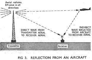
Aircraft scatter, occurs where an aircraft is flying in the air along a signal path. The signal may not be available until the aircraft is at the midpoint, half way between your location and the transmitter, but it can occur at any point. The metal of the aircraft may be able to reflect the signal, which would otherwise be attenuated along the ground, either because of the large distance involved or because the signal has been attenuated due to nearby terrain.
The maximum distances for two way radio communications using ground stations and aircraft reflections up to 40,000 feet are theoretically around 800km (500 miles) and the duration can be for several minutes. This distance is estimated from the maximum ground to commercial aircraft altitude being 400 km or 250 miles, which is both mathematically correct and confirmed by observed ADSB radar plots.
If you see any Aircraft Scatter (AS) spots on the DXcluster where the stations are over 800 km apart be extremely sceptical that the correct propagation mode has been identified. The typical AS range worked on VHF amateur radio bands (50/144 MHz) is usually around 200-500 km, however can be up to 850 km on the 10 GHz band
The most common effect of aircraft scatter is to cause a rapid flutter of the propagated signal. An aircraft flying at low altitude travels close to the signal path and begins to affect the received signal. The fist signs are when the signal becomes choppy. A rapid flutter becomes audible where the signal fades cyclically. The cycle becomes shorter and after a minute or so the fades appear to stop. A few seconds pass and the fluttery fading starts again, becoming more and more rapid until the effect passes. This happens because the signal is arriving from two angles: from the ground wave and via the aircraft reflection. The distance travelled by each signal is slightly different and as the aircraft moves around a phase cancellation effect occurs which produces the fading effect.
In order to cause a radio reflection an aircraft must have both the transmitter and receiver within its line of sight "radio horizon." The minimum altitude for a reflection is lowest at the transmitter-receiver baseline midpoint, with the minimum altitude about four times as high over either the transmitter or receiver.
A few examples of the midpoint altitudes needed and maximum 2 way Ground distances (i.e. ground to aircraft and back to ground) are:
|
Maximum Ground Distance for 2 way QSO |
Minimum aircraft altitude |
|
Up to 1000 km |
20 km (65,000 feet) |
|
Up to 750 km |
11 km (36,000 feet) |
|
Up to 500 km |
5 km (16,000 feet) |
|
Up to 250 km |
1.2 km (4,000 feet) |
|
Up to 125 km |
0.3 km (1,000 feet) |
I have had SSB voice QSOs using this mode usually on 144 MHz (2 metres) and in the region of up to 250km distance and more recently greater success using JT6M data mode on 50 MHz at a distance of around 350km, where the reflections are longer and more stable.
I am on the main transatlantic flight path between Heathrow and the Hebrides as well as being reasonably close to Manchester, Newcastle, Glasgow and Belfast airports. I have RAF Spadeadam, a NATO electronic warfare range just to the North of me so am used to seeing lots of military aircraft and helicopters too.
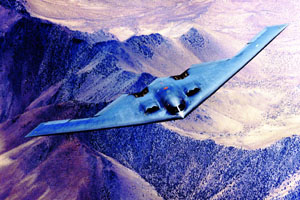
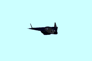
Most civilian aircraft fly at a cruising altitude of no more than 12,000m or 37,000feet, but there are a few modern military aircraft, which fly much higher. However due to their Radar Absorbing Materials (RAM) and Stealth technology, they are intended to deliberately not reflect back any radio waves and thereby defeat enemy Radar, which might otherwise detect them.
The shorter the distance between the transmitter and receiver, the more levels of air traffic that become available to cause reflections, over a broader geographic area. Due to their slower speed, aircraft tend to have much longer reflection durations, when compared to meteors.
The aircraft will simulate an extremely slow "head" echo, with its associated oscillating diffraction pattern. The stronger the normal atmospheric scatter signal is at the receiver, the more pronounced these oscillations will be. This will create a symmetrical signal of a series of either accelerating or decelerating oscillations. The centre of these oscillations is usually occupied by a large peak which last from about one to fifteen minutes. The higher the operating frequency, the more likely it is for an aircraft to cause a reflection.
An experimental data mode SlowFeldXPAS designed for use specifically for aircraft scatter can be downloaded here. Depending on how close you are to major air routes will affect how many reflections you can detect.
Watch here how Rex VK7MO beat the Australian distance record for Microwave using ACS
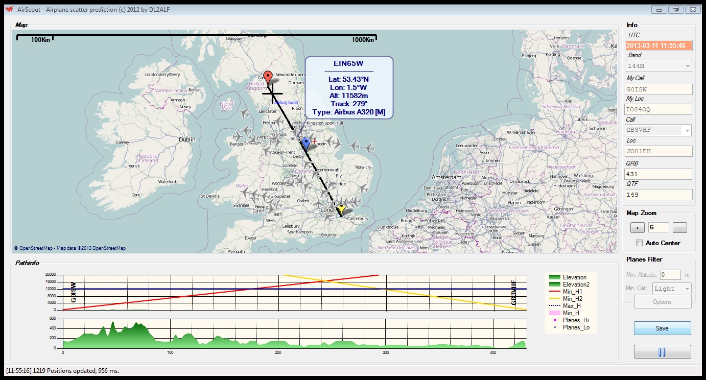
Now in March 2013 I have just discovered some fantastic software called AirScout by DL2ALF for live real-time Aircraft Scatter propagation analysis with live mapping too.
Here is a screen shot showing the projected 144 MHz signal path between my station G0ISW at IO84OQ and the GB3VHF beacon at JO0EH. The area for mutual Aircraft scatter propagation, roughly the mid point distance wise between the two amateur radio stations, is shown in the 'Pathinfo' box at the lower part of the screen. Flights in this area will appear in the box. However that potential ACS area is above the set maximum flight height of 12200m set in the software indicated by the dark blue line in the 'Pathinfo' box, so is suggested as being non viable for this distance of 431 km.
For the live aircraft flight tracking, required by AirScout, I used the Flightradar24 website.
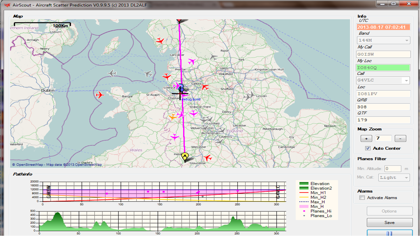
In this second alternative screenshot example below the projected 144 MHz signal path between my station G0ISW at IO84OQ and G4VLC at IO81PV, a distance of 311 km, is shown. The maximum aircraft altitude has been set at 12000m in the software, the Aircraft Scatter Propagation (ACS) zone is shown in purple.
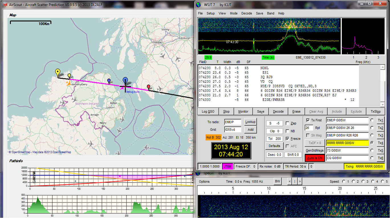
Interestingly on 12th August 2013 at 0744 UTC I also worked EI9E/P in IO55VD square, 350 km away from me so too close for easy Meteor Scatter and the angle of elevation being too high for typical MS heights. I heard many very brief MS pings from this station but couldn't work him randomly. I then noticed some longer none MS reflections that were random and not Troposcatter, using AirScout software by DL2ALF I was able to observe that all these longer 15-30 second reflections were actually via Aircraft Scatter (ACS) propagation with planes flying over the Irish Sea crossing the path between our two stations.
Looking for a really good flight path I then worked EI9E/P with ease, see screen shot below. Notice the pink coloured mutual scatter zone and the pik coloured aircraft that allowed us the QSO, the metallic body of this plane being an excellent reflector even at 50 MHz. I took the screen shot after the QSO was nearly complete so the aircraft had travelled slightly over the path line. Had I clicked on the aircraft icon I would have known what the flight and aircraft type was.
Aircraft scatter propagation (ACS) has been regularly used successfully on frequencies of 50 MHz and above. It can be subject to rapid fading of signals at 144 MHz and higher frequencies and may not be particularly easy to catch or use.
Imagine bouncing your radio signals off the metal aircraft body, which will be travelling at between 500-600 mph, in the same way you would bounce light off a mirror. Due to the speed of aircraft transit, maximum 30 second transmit periods are recommended and data modes such as JT6M (30s periods) or ISCAT-B (30 or 15 second periods) will probably yield the best results.
I have often found using 50 MHz and JT6M data mode that identified Boeing 747 airliners are sufficiently large, with their 64m wingspan, to produce good aircraft scatter. The scatter period on 50 MHz can last up to around 1 minute if crossing the direct path between stations and significantly longer if flying along the direct path.

Due to the curvature of the Earth and VHF signals being line of sight there is a maximum distance limit as to how far Aircraft Scatter (ACS) propagation can be used. This maximum distance is approximately 758 km for Civilian commercial aircraft reflections.
Also this maximum theoretical distance using commercial airliners does not take into account any path attenuation.
Using the calculations seen before for VHF line of sight signals we find that for a signal from a commercial aircraft altitude to sea level, the theoretical maximum radio horizon is 379 km as shown in the calculation below.
Example: Commercial aircraft at normal maximum 11,276 m (37,000 feet) altitude, carrying Amateur radio transmitter
Horizon Km = 3.569 x √ 11,276 metres = 379 km (235 miles)
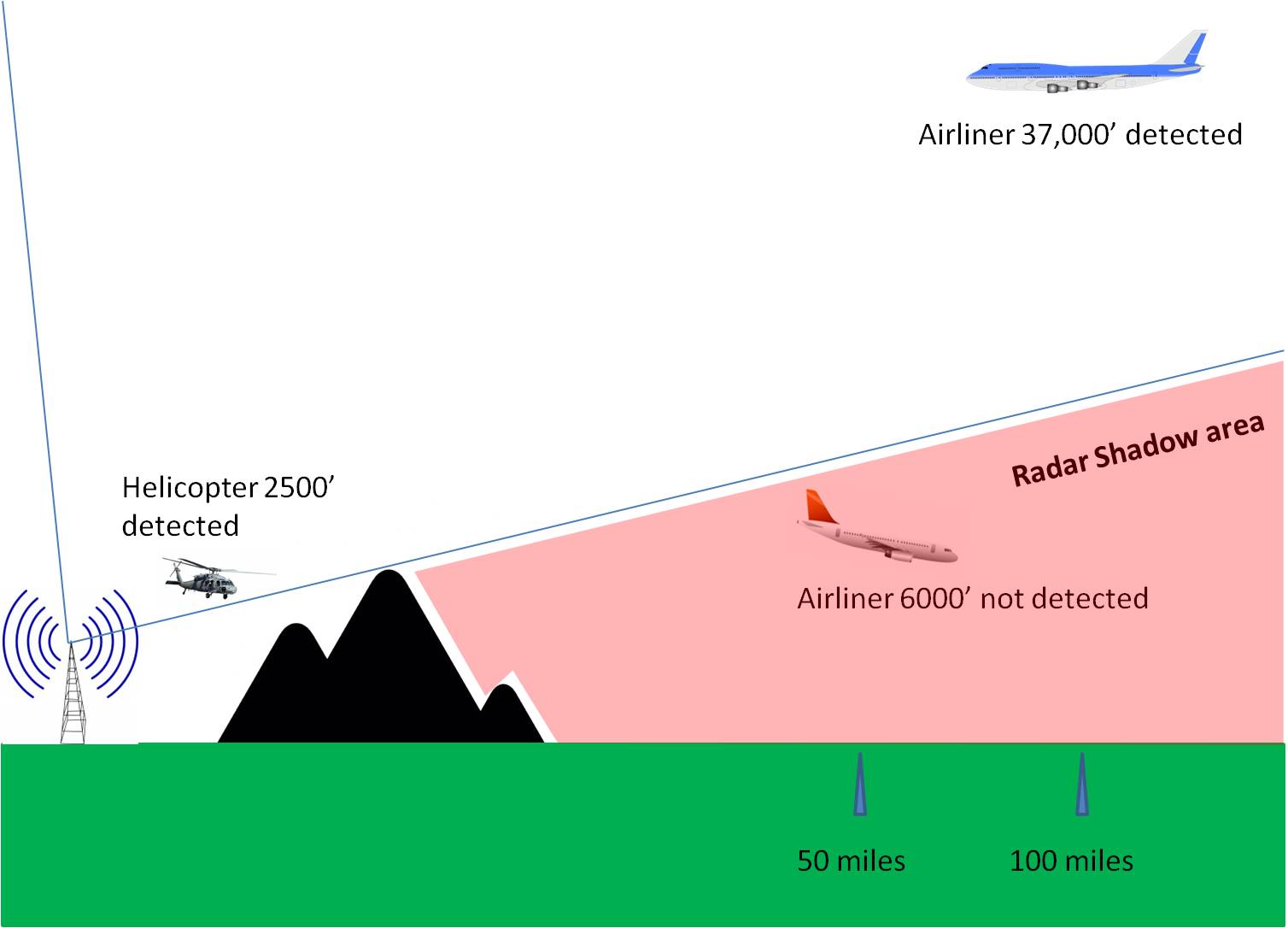
However, from my own recorded results the very best distance line of sight to a Civilian commercial aircraft I have obtained has been 372 km (231 miles) due to nearby ground obstructions i.e. mountains. This zone of no line of sight could be referred to as a Radar Shadow Area (RSA), see image below for a better understanding how closer aircraft can be hidden yet further away higher aircraft ADSB transmissions can be observed.
Some modest increase in theoretical distance will be exhibited by amateur radio stations being at an elevation above sea level. However even the top of mountains will only add about 110 km more so the distance could be extended to nearly 500 km
So for the two legs from ground station to aircraft and scattered back to ground the maximum theoretical distance is 2 x(379+110) km = 978 km.
Do any aircraft ever fly higher than 11,276 m (37,000 feet)?
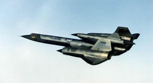
Yes, historically the supersonic Concorde used to fly at a cruise altitude of 18,900 m (62,000 feet) and the US Air Force SR71 Blackbird reconnaissance aircraft set an altitude record in 1976 of 25,950m (85,135 feet) although it is likely it could fly higher, but that maximum remains classified.

Some smaller modern military jet fighters apparently have a service ceiling of 65,000 feet, but stealth radar absorbing materials used to avoid enemy detection by radar will also prevent amateur radio aircraft scatter.
The only aircraft I have observed at significantly higher altitudes have been rare U2 flights passing over the United Kingdom with a transmitted height of 60,000 feet, although they could have been at a different higher altitude apparently as anything over 60,000 feet is deliberately not shown.
There may be other classified experimental military aircraft operational today, but due to the limitations of having air-breathing engines they too are limited in maximum altitude.
If we use 25,950m (85,135 feet) as the maximum possible, but most unlikely, theoretical and practical altitude then the radio horizon would be:
Horizon Km = 3.569 x √ 25,950 metres = 575 km and for ground to aircraft scatter and back to ground that distance would be doubled to 1150 km in theory!
Also the aircraft size is key to whether or not is offers enough surface area for the transmit frequency in use, at 50 MHz (6m) it appears an aircraft the size of a Boeing 747 with a 64m wingspan is required for good results.
Smaller identified aircraft such as Boeing 737, with 34m wingspan, have not been observed by me to have as much success on 50 MHz, surprisingly.
Realistically for all amateur radio purposes a practical maximum for aircraft scatter (ACS) two way radio signal propagation remains around 700-1000 km and the 700 km distance being the most realistic.
Any DX spots showing aircraft scatter (ACS) over this maximum 1000 km distance can only be operator error and should be discounted, with another propagation mechanism such as MS or Es being the actual medium used.
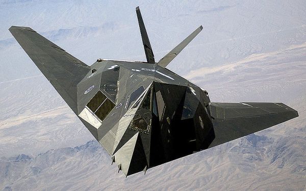
RADAR (Radio Detection And Ranging) has used radio signals since before WW2 to determine the flight path of aircraft. Early German WW2 radar used frequencies near to the amateur 144 MHz band. Modern stealth aircraft such as the US Air Force F-117 were designed so that their shape would not easily reflect Radar signals back to the receiving station, by avoiding having any vertical angles.
Some early experimentation has been done by SM6FHZ and his website detailing how to work regularly via this mode, using flight timetables is here. Frequencies of 144 MHz, 432 MHz and 1296 MHz have all been used successfully by him. Some imagery and an explanation of how you can experiment to listen yourself can be found on the website of G3CWI here.
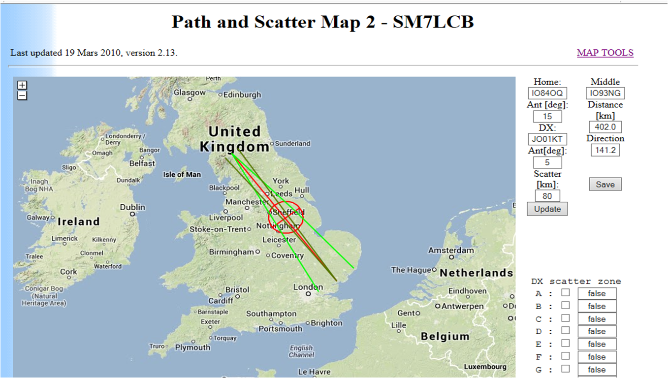
Also the website of PA0EHG provides a fascinating account of his experimentation at 1296 MHz a frequency particularly well suited to ACS propagation, as well as his use of SM7LCB online Path and Scatter maps.
Since 2013 a fabulous new piece of software called AirScout has been written by Frank DL2ALF especially for Aircraft Scatter propagation. You get moving aircraft over a map in real-time as well as a plot showing where your signal and the station you are trying to work have a mutual reflective scatter zone into which the aircraft can fly and their times predicted.
Additionally a path profile is generated which shows obstructions such as mountains. This software is a superb tool to assist others for ACS research and real-time working and of course fun!
In the Summer of 2013 I first experimented with this software and using WSJT JT6M data mode on 50 MHz SSB was able to take advantage of regular aircraft scatter (ACS) between the UK and Ireland at a distance of 350 Km. The 30 second transmission periods for JT6M fitted perfectly the 1 minute long observed reflections, with fairly stable strong signal strengths seen. Happy days!
Since then I have had many successful contacts on 50 MHz using aircraft scatter and have even been able to predict the reflections timed to the minute using AirScout software by DL2ALF.
Signal strengths have been often observed at 6-12 dB.
Of course apart from reflecting your radio signals, the aircraft themselves can also be detected using radio - Radio Detection and Ranging - RADAR

Introduction to RADAR principles
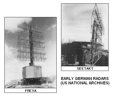
During WW2 the German Freya radar system, which was the first operational early warning radar system, used VHF frequencies very close to the current Amateur 144MHz (2m) range. View the Battle of the beams for more info about WW2 radar development. Or visit this page by LA8AK for an interesting tour of what remains in Norway now of these radar systems.

You can visually observe aircraft scatter for yourself using passive Doppler Radar. Have a look at the site of G3CWI for a full description. Or you may be interested in the new Kinetic Aviation SBS-1 real time virtual radar system, simply plug it into your PC, load the software and it is ready to track aircraft straight away.


|
|
Official website
|
||
|
|
Low flying in the Lakes |
||
|
Lancashire aircraft investigation team
|
|||
|
Military aviation & space projects |
For the Military Aviation enthusiast |
|
|
|
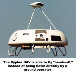
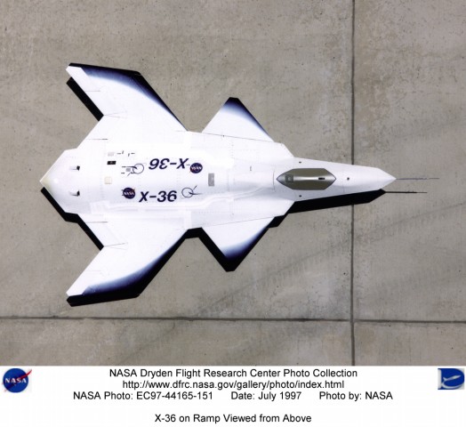
High altitude long endurance UAV
|
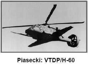
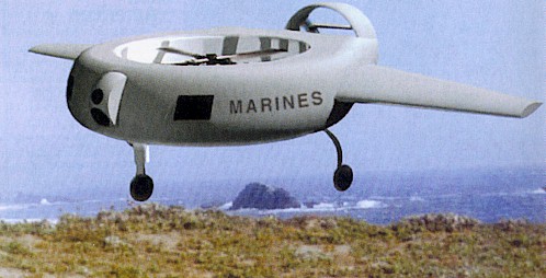
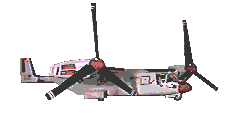
50% helicopter & 50% plane |
Unmanned combat aerial vehicle |
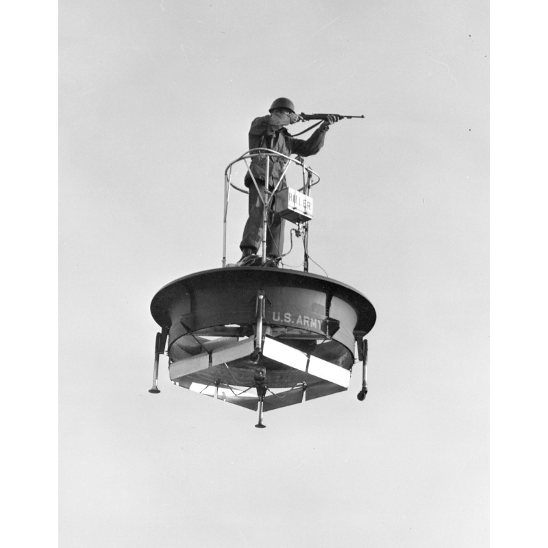
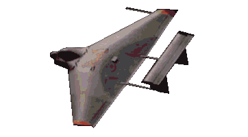
Multi axis No Tail |
|
Aerospace archaeology team for Experimental aircraft |
Look-up by aircraft designation
|
|
|
|
US Area 51 research
|
US Area 51 matters |
Satellite photos |
|
|
Tom Mahood the finder of the crash site is a Radio Amateur! |
Scramjet Mach 9.6 (7,000 MPH) |
Defence Advanced Research Project Agency |
US National UFO reporting centre |
|
My favourite helicopter |

![]()
|
|
|||
|
University of Cambridge High Altitude Balloon flight predictor |
Amateur Radio High Altitude Balloons listing
|
||
|
Amateur Radio High Altitude Balloons
|
|||
|
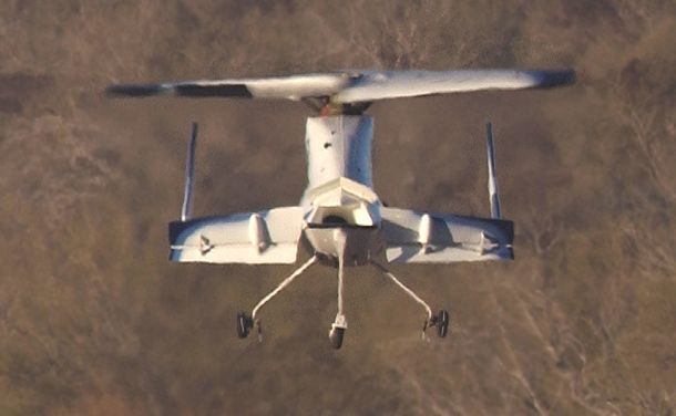
Exotic Aircraft/Jet packs/Wings/UAV |
|
|
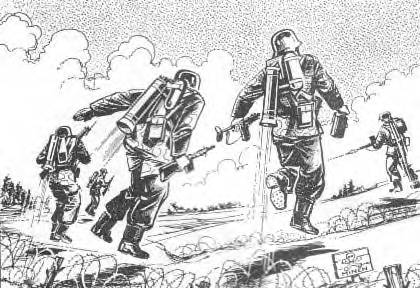
Artist impression of WW2 German Himmelstürmer jet pack designed to allow 50-70m long jumps over minefields/obstacles, in development 1944-1945 |
|
|
|
|
|
|
|
|
|
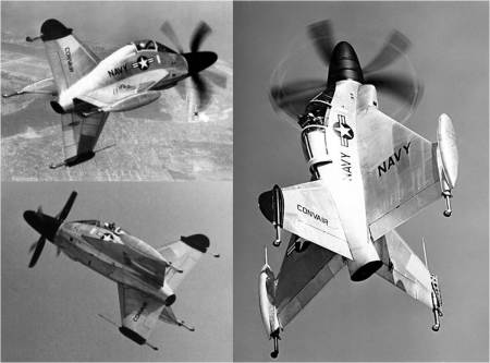
US Navy VTOL XFY-1 Pogo |
|
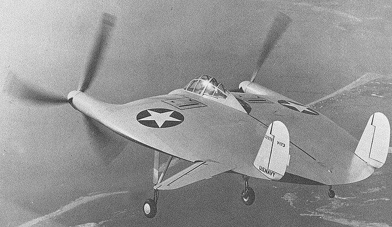
US Navy XF5U/V-173 'Flying Pancake' 1940's |
|
|
|
|
|
|
|
|
|
|