DXpedition to Nicaragua
Click here for
|
GEOGRAPHY |
|
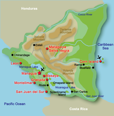
Bordered by Costa Rica on the South and Honduras on the North, Nicaragua is the largest Central American republic. The vast Pacific Ocean forms her western border, the balmy Caribbean Sea the east. It is a warm and friendly land of lakes and mountains; rivers and volcanoes, sea and sun. The country is divided into three geographic regions: the Pacific Lowlands on the west, the mountainous Central Region and the Atlantic Lowlands on the east. The Pacific Lowlands: This lowland area runs from the Gulf of Fonseca, on Nicaragua's Pacific border with Costa Rica south of Lake Nicaragua. From this lowland strip, the Maribios mountain range, with its 25 volcanic cones, towers overs some of the most beautiful and impressive beaches found anywhere else in Central America. This region is the most populated. About 27 percent of the nation's entire population lives in and around Managua, the capital city, on the southern shores of Lake Managua. Few Latin American capital cities share Managua's picturesque location. Being on an open plain, it does not suffer the pollution of other capitals trapped in mountain valleys. In addition to its beach and resort communities, the Pacific Lowlands is also the repository for much of Nicaragua's Spanish colonial heritage. Cities such as Granada and Leon abound in Spanish colonial architecture and artifacts. The Central Region: Hikers and backpackers, walking along the tree shaded paths can quench their thirst in the clear waters of the mountain springs. A lucky bird watcher may be able to add a rare quetzal to their inventory. Most certainly they will see goldfinches, hummingbirds, magpies or toucanets. Taking a branch of the famous Pan American Highway, the traveler can drive through the heart of this region to the border with Honduras. The Atlantic Lowlands: Nature lovers will find much to peak their interest in the tropical forests of the area. A great variety of birds are to be studied including eagles, turkeys, toucans, parakeets and macaws. Animal life in the area includes several different species of monkeys, ant-eaters, white-tailed deer and tapirs. It is well worth the time to take the short flight from Bluefields to the Corn Islands. These small, beautiful islands are fringed with white coral and are a popular resort area for many Central Americans. They are a perfect spot for bathing, surfing, fishing and the small island even has a mountain to climb. If you are a lover of seafood and shell fish, the Corn Islands is the place to be.
|
|
MONEY |
|
Currency: Nicaraguan Gold C�rdoba (C$) = 100 centavos. Notes are in denominations of C$100, 50, 20, 10, 5 and 1, and 50, 25, 10 and 5 centavos. 1US$ abt 14 Cordoba Credit cards: |
|
SIGHTSEEING |
|
Museums and historical sites
Managua: The centre of the capital was completely destroyed by an earthquake in December 1972 and there was further severe damage during the civil wars of 1978-1979. The Government has now decided that it will rebuild the old centre, adding parks and recreational facilities. In the old centre of Managua one can still see examples of colonial architecture in the National Palace and the Cathedral. Places of Interest: There are several volcanic crater lagoons in the environs of Managua � centres of watersports and residential development with boating, fishing and picnicking facilities. Laguna de Xiloa is the most popular of these lagoons. Boats can be hired on the shores of Lake Managua for visiting the still-smoking Momotombo volcano and the shore villages. On Tiscapa Lagoon there is a recently-built recreation centre.Le�n: The 'intellectual' capital of Nicaragua, with a university, religious colleges, the largest cathedral in Central America and several colonial churches. There was heavy fighting here during the civil wars of 1978-1979 and much of it was damaged.Granada: Lies at the foot of the Mombacho volcano. It has many beautiful buildings and has faithfully preserved its Castilian traditions. The cathedral has been rebuilt in neo-Classical style. Also of interest are the Church of La Merced, the Church of Jalteva and the fortress-church of San Francisco. |
|
WEATHER |
|
Nicaragua has a predominantly tropical climate, alternating between two seasons: rainy and dry (winter and summer). This is the result of its geographic location between 11 and 15 degrees latitude north and the humidity from both the Atlantic and Pacific oceans which give it a fairly stable season. In the Central Region the rainy season lasts from May to October. The dry season occurs from November through April. During December the weather is more temperate. The warmest months are March, April and May, Nicargua's "sea season". The climate in the Atlantic Coast has been classified as having the highest temperature and humidity. The temperature in this region corresponds to that in tropical jungles and ranges above 89� F. |
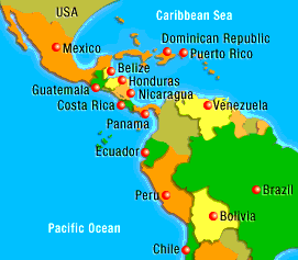
Middle and South America
Nicaragua

Landscape
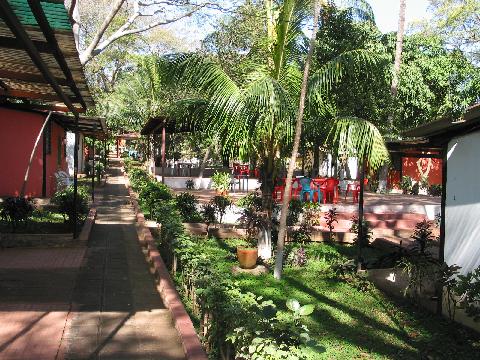
The
hotel Ticomo should be our planed location... but no chance to build up
any antenna. A green roof of trees covered the whole hotel garden
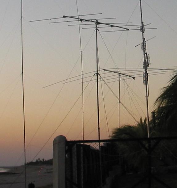
So we moved to Pochomil at the pacific coast to install our antenna forest
 |
 |
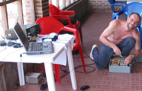 |
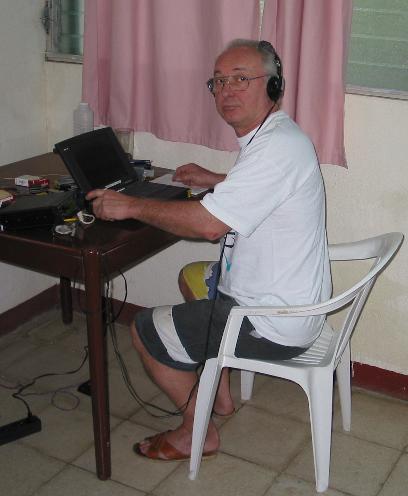
DL3DXX DL7CM DL2OE
 A letter outside of Europe costs 1,53 Euro. That means 2 green stamps!! Thank you.

