Yukon / "Top of the World" Highway

---------------------------------------

Driving in this part of the world is always a challenge. From pavement to gravel to mud roads pocked with potholes, it's not an exercise for the faint of heart. Warning signs are everywhere, and frequent rain makes things even more unpredictable.

---------------------------------------

Hundreds of miles of fairly monotonous rough roads just beg the driver to travel at speeds much greater than probably should be attempted...

---------------------------------------

Dawson City, Yukon's main northern settlement. After hundreds of miles without seeing many people or traffic, this tiny city seemed like the most modern of metropolises.

---------------------------------------

We drove a counterclockwise circular route, beginning in Whitehorse and then traveling north to Dawson City, across the Alaska border at Poker Creek (most northern land border in America!) through Chicken and down to Tok, crossing back into the Yukon at Beaver Creek (Canada's most western community!), and finally arriving at Haines Junction, gateway to Kluane National Park, arguably the Yukon's most picturesque region. The border between Alaska and the Yukon is well marked but very loosely staffed in the high latitudes. Poker Creek had only two US officers; Beaver Creek in Canada had only one. Below a few shots of the international frontier, including the cement bench that sits astride the border, one of the concrete border markers, as well as a telephoto shot showing the borderline disappearing through the forest on the horizon.

---------------------------------------

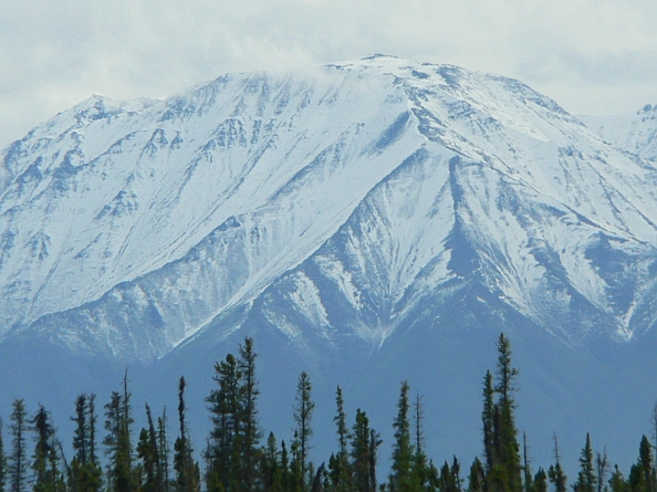
The scenery was often breathtaking, such as this view from a roadside turnout at Quill Creek.

---------------------------------------

Wolf, squirrels, birds, muskrats, moose, and bear were just some of the wild creatures encountered during the drive.

---------------------------------------

Finally after days on the open road, we come to the highlight destination of our trip, the town of Haines Junction at the foothills of Kluane National Park. Virtually all of Kluane is inaccessible by road, but the highway runs along the park's outer boundary and offers breathtaking views for hours. We stayed at the Cozy Corner Motel in Haines Junction for a couple action-packed days. Very reasonably priced with views to die for.

---------------------------------------

Kluane National Park, together with Wrangell-St Elias National Park across the Alaska border, have been jointly declared a United Nations World Heritage Site. Kluane consists of a series of parallel mountain ranges, each higher and more remote than the next. From the road it's only possible to view the closest of these peaks; you have to take to the sky to see most of the peaks, including Mt Logan, Canada's tallest at 19,551 feet. Within this huge mountain massif are the world's largest non-polar ice fields. Uncooperative weather made flightseeing a challenge, but after two days of trying we finally had conditions that allowed us to get airborne for the fantastic snapshots of Kluane below.

---------------------------------------

The road takes as much of a toll on one's rental car as on the drivers themselves. Below, a study of contrasts: on the left, a snapshot of our license plate when we picked up the car at the airport in Whitehorse. To the right, the same view when the car was returned.