China / North Korea Border
Dongbei refers to the provinces of China's far northeast, historically also known as Manchuria. The region is known for its bitterly cold winters and for its large ethnic Korean population due to its proximity to North Korea. This trip took me along the entire length of the China/North Korea border from Fangchuan in the northeast down to Dandong in the southwest. In some ways, it is actually easier to photograph North Korea from the safety of Chinese soil rather than in North Korea itself. The river border is very narrow in many parts, and a good zoom lens is all one needs for candid glimpses of life inside the world's most isolated country. Pictures can be taken freely without interference from North Korean minders. Tours of North Korea never allow access to restricted border areas and guard towers, but these are also easily viewed and photographed from China as well.
This gallery is made up of photographs from lesser-traveled border frontier areas from vantage points in China across the Tumen and Yalu Rivers from North Korea. Pictures of the largest border city Dandong and its environs can be found by clicking here. Famous Changbai Mountain straddles the border and is worthy of its own page as well, which you can access by clicking here.
-------------------------------------------
In Fangchuan, Chinese territory tapers off into a narrow corridor that ends where the boundaries of three countries meet. From this one spot it is possible to view China, North Korea, and Russia all at the same time. Below is a massive Chinese pavilion in the Three Borders Area that is visible from North Korea and Russia as well.
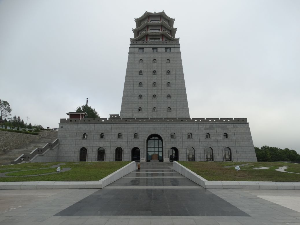
Click here to see what this same building looks like from the North Korean side of the border.
-------------------------------------------
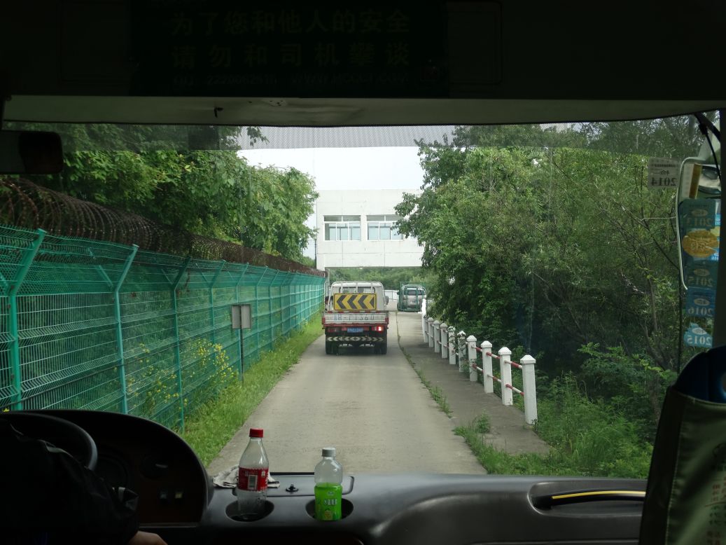
At the heart of the Three Borders Area traveling on what is certainly one of the narrowest and most unique roads in the world. Russia is to the left, China straight ahead up to that white concrete building where the road ends, and North Korea hidden behind the trees to the right.
-------------------------------------------
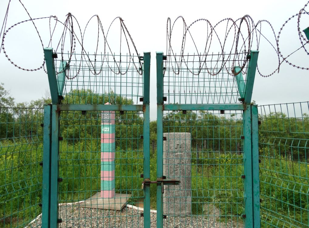
The literal end of the road. Russia to the left. North Korea to the right. Chinese territory ends at the small white border marker straight ahead. Beyond that, just visible in the top center of the picture, is the railroad bridge that connects Russia with North Korea.

-------------------------------------------
China and Russia border markers side by side at Fangchuan.
-------------------------------------------
Panorama shot from atop the Chinese pavilion at the Three Borders Area.
Russia to the left, China straight ahead to the small white concrete watch tower, and North Korea to the right.

The Chinese map below shows precise boundaries of each country in the view above. Russia (yellow) to the left, China (red) in the middle, North Korea (blue) on the right.

-------------------------------------------
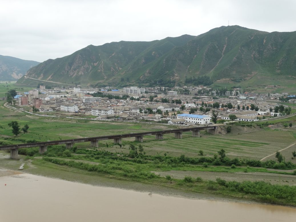
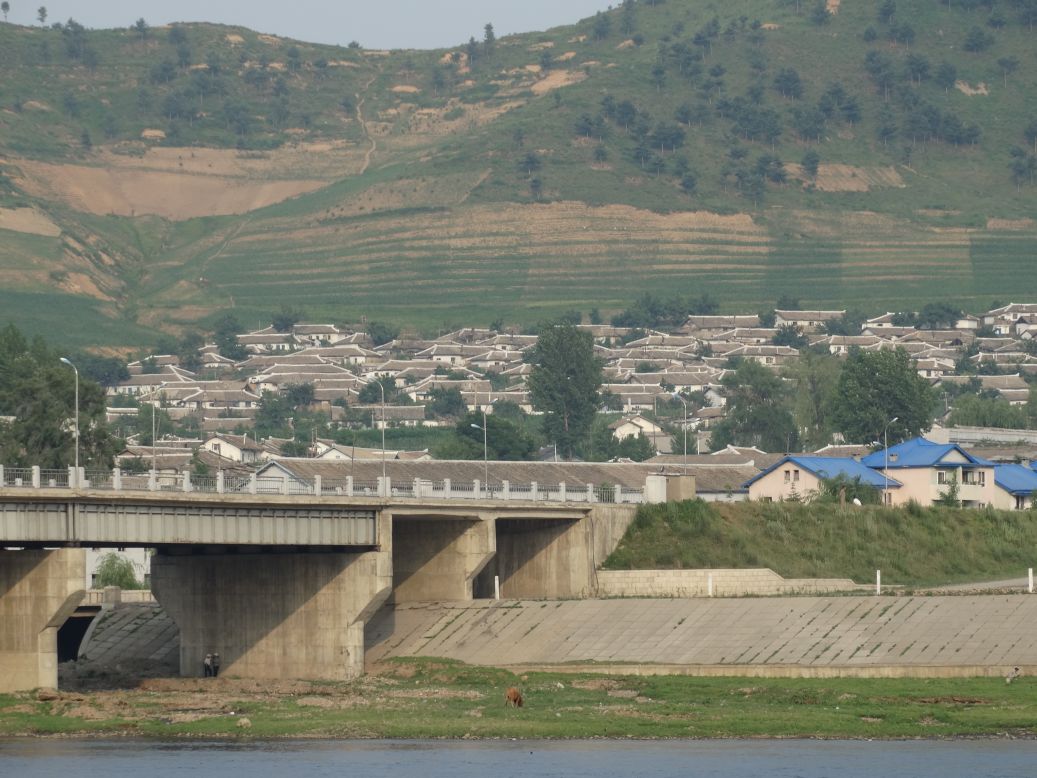
Bridge over the Tumen River that forms China's northeastern border with North Korea. The North Korean city of Namyang is visible in the background.

-------------------------------------------
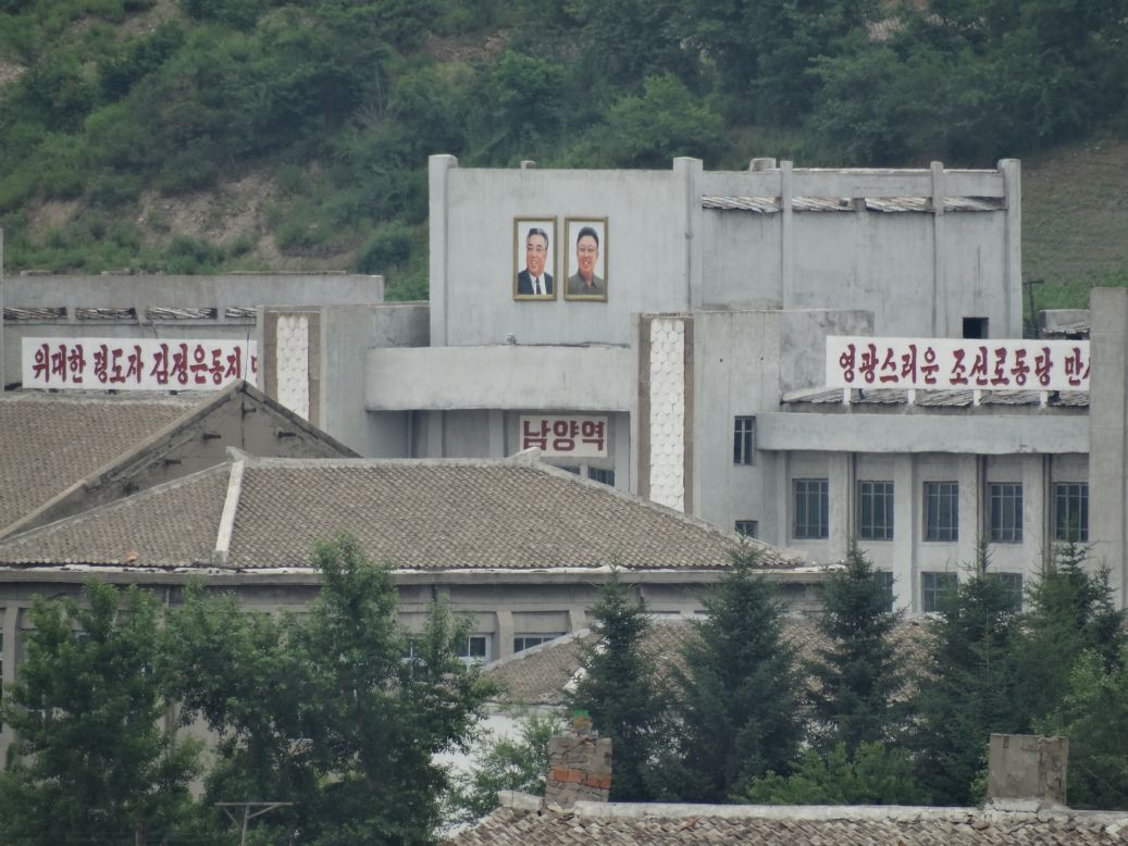
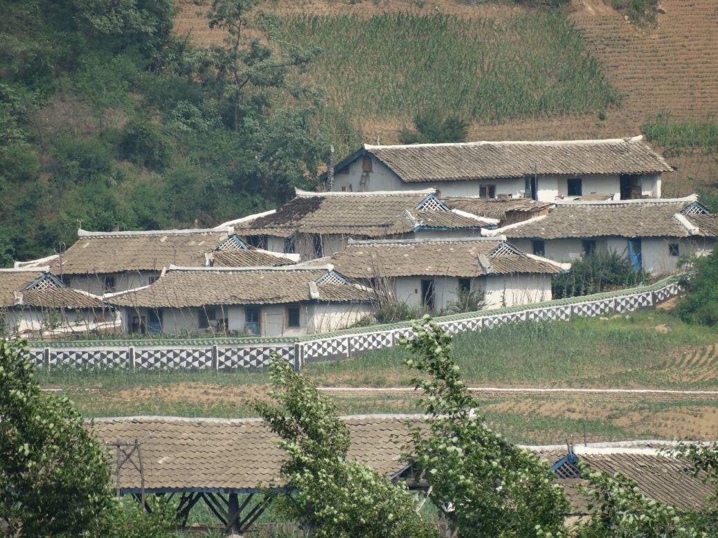
Closeup of some of the decrepit concrete buildings of Namyang viewed from across the river in Tumen.

-------------------------------------------
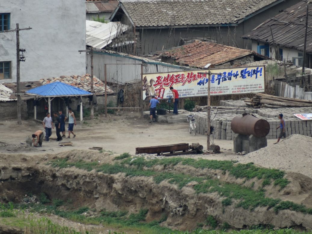
Border warning sign. China and North Korea are allies, and there are several weak attempts along the border to shield North Korea's poverty from prying camera eyes.

-------------------------------------------
Cutting across some farmland below the Tumen River bridge brings us right to the riverbank and directly across from a North Korean border guard who is quite curious about the sudden appearance of a Caucasian face right across the water from him.
-------------------------------------------
Panorama shot of the Tumen River. Chinese city of Tumen on the left, North Korea's Namyang on the right.

-------------------------------------------
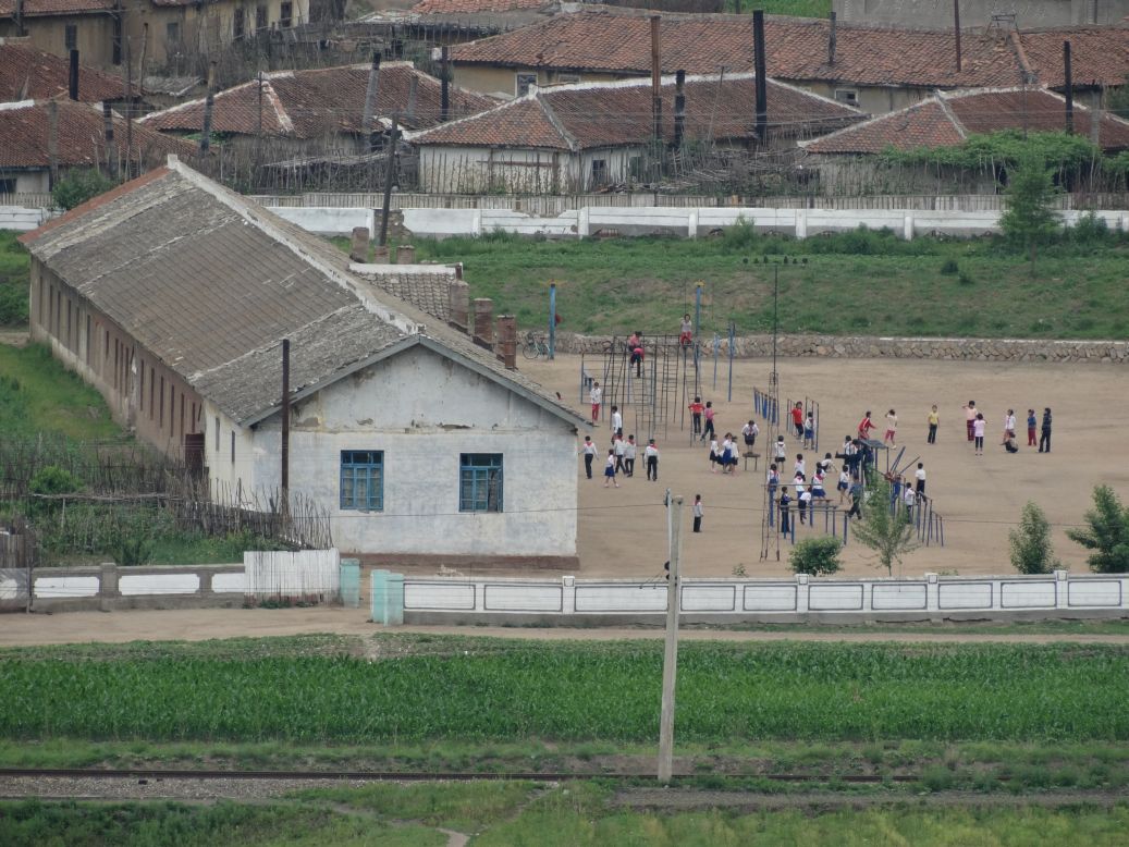
Beautiful shot of Namyang, North Korea, from hillside lookout in Tumen, China.
-------------------------------------------
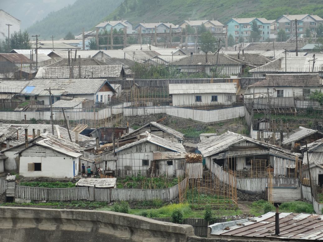
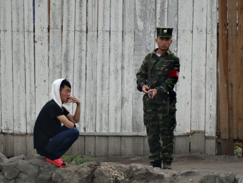
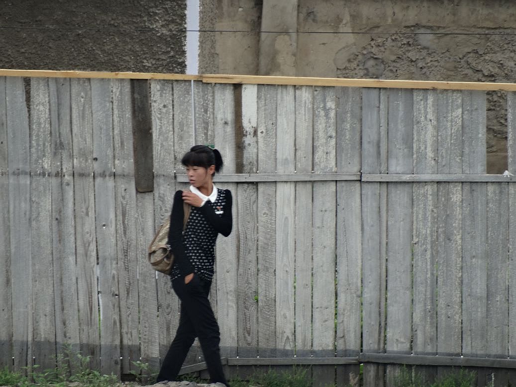
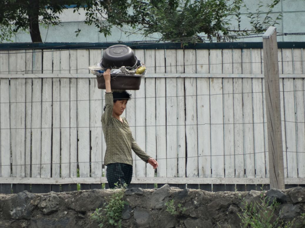
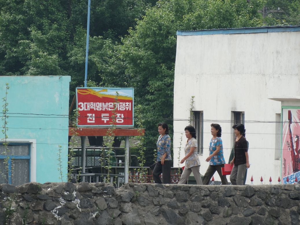
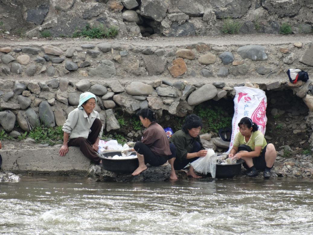
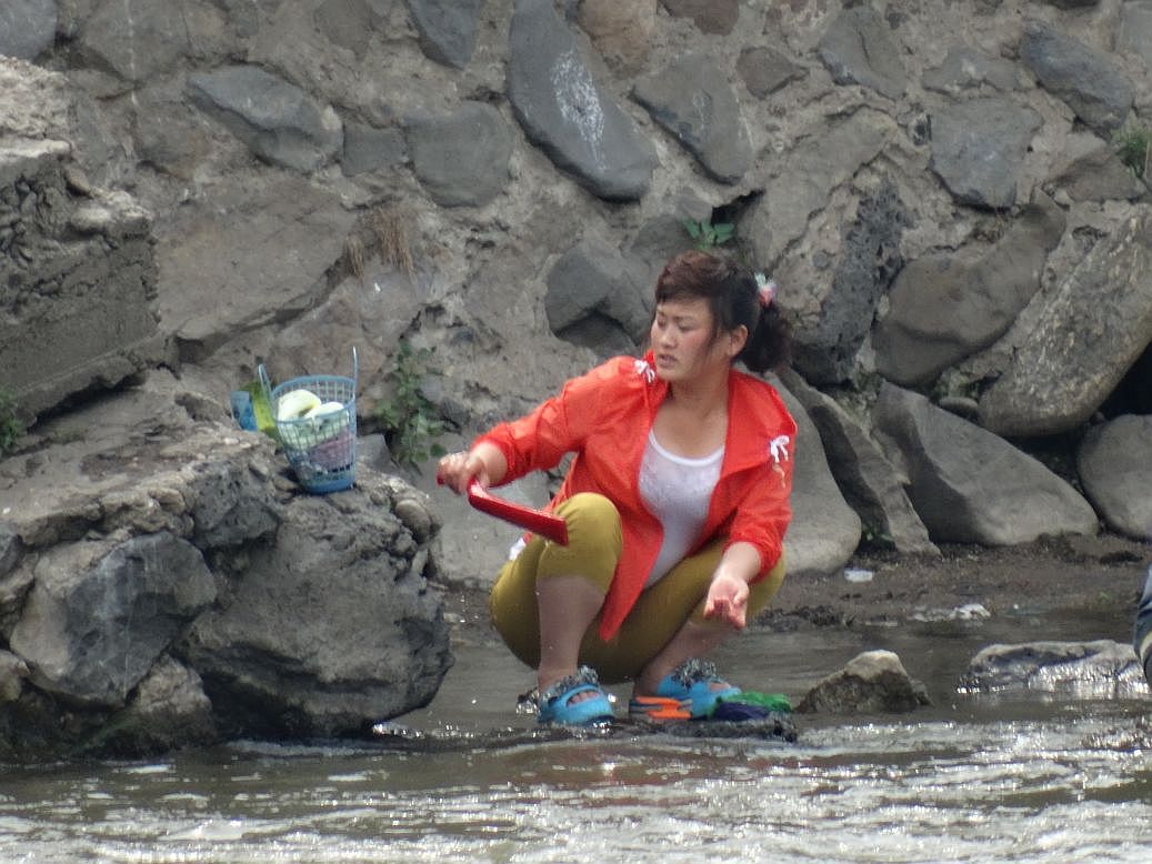
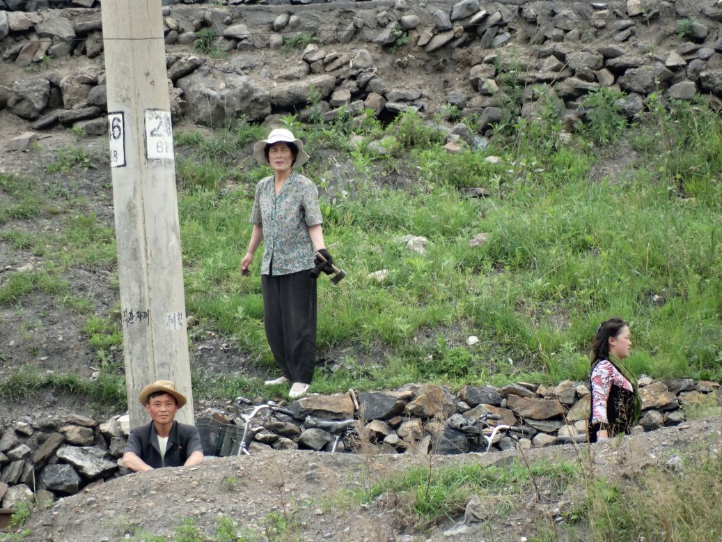
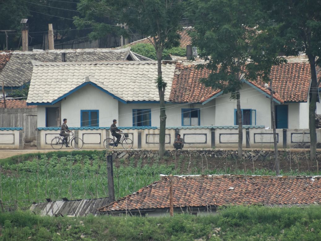
I spent a good chunk of time watching the people and places in Namyang, North Korea, from afar.
-------------------------------------------
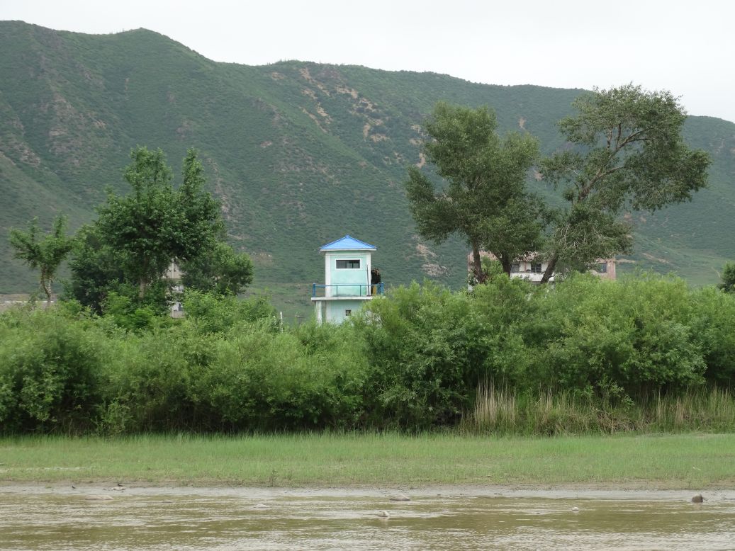
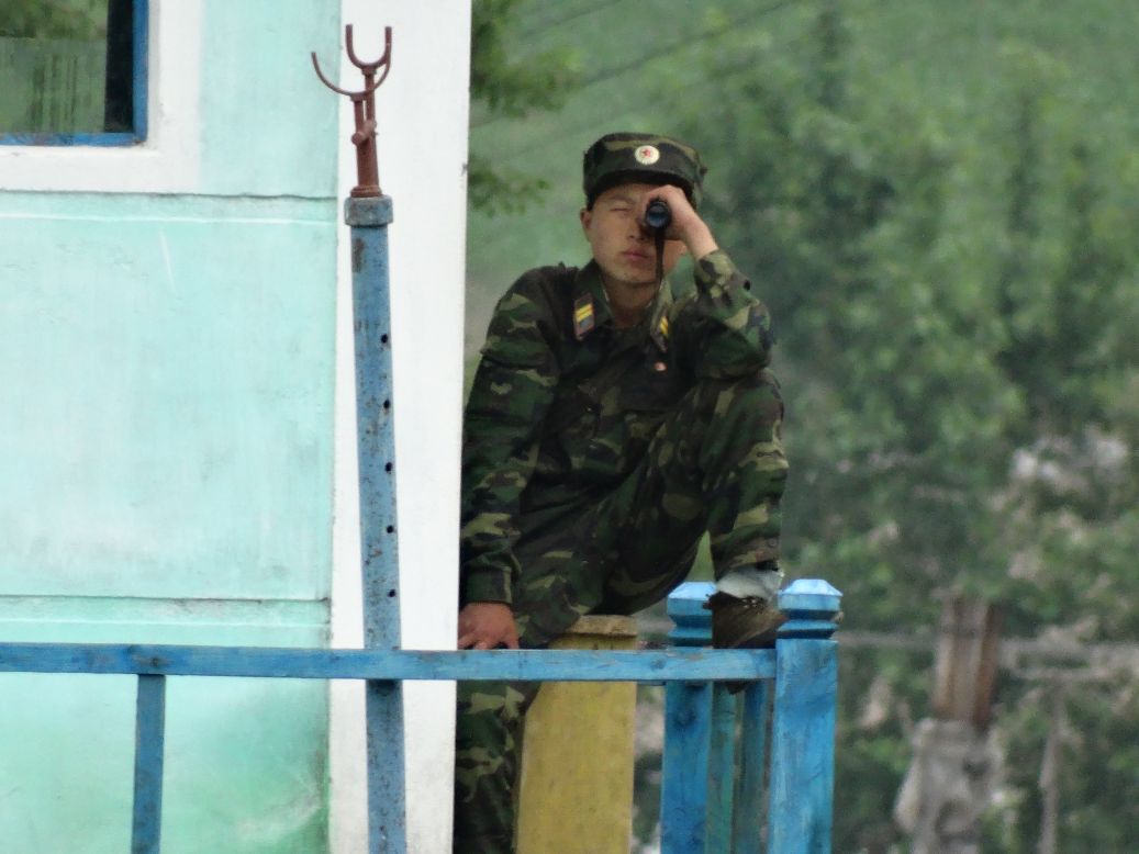
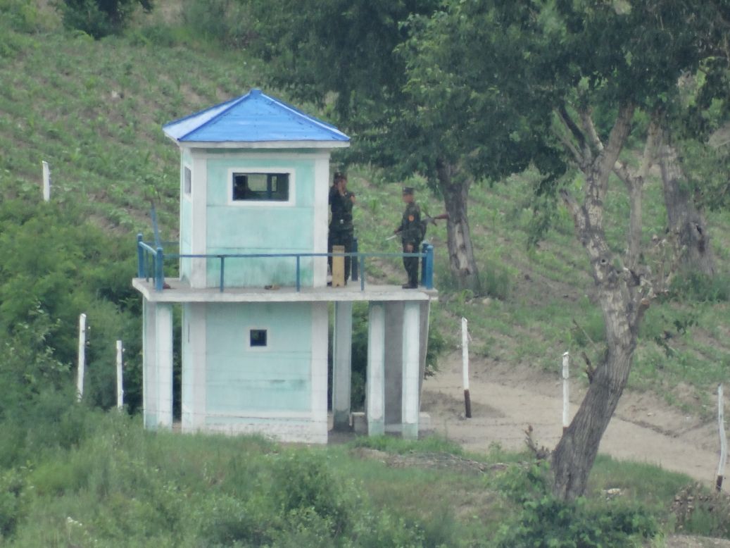
From my overlook in China, I spotted a North Korean guard tower far off in the distance. I had assumed I was way far enough away to be able to watch them surreptitiously, so I was simultaneously shocked and creeped out when I looked through my zoom lens and noticed that they were watching me as well.
-------------------------------------------
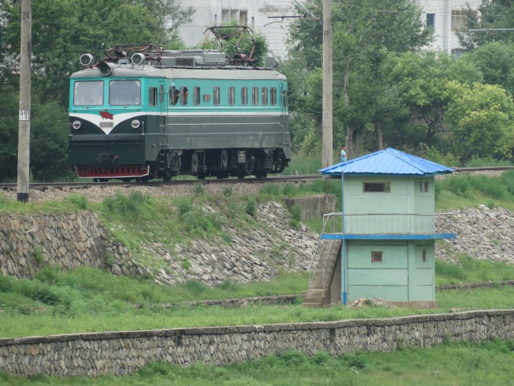
Typical shot of the border fencing between China and North Korea.
The two countries consider the river shared territory, so the actual physical border for each begins on the riverbanks on each side.

-------------------------------------------
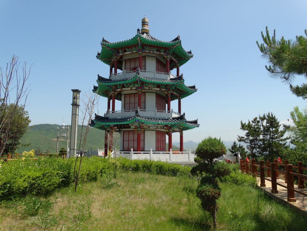
The terrain is mountainous in this part of the world, which made finding good vantage points for views into North Korea easy to find. This gorgeous pagoda on the Chinese side of the border sits atop a hill overlooking the North Korean city of Hoeryong below.
-------------------------------------------
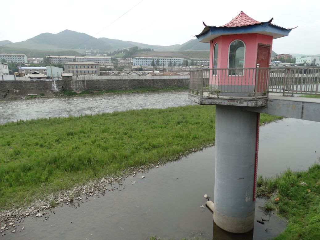
Striking North Korean immigration and customs buildings in Hoeryong. The facilities were built with Chinese money, but at present China and North Korea are in the midst of one of their periodic feuds so the border crossing was completely quiet on the day that I visited. No people were visible anywhere, and no sounds were to be heard. The two trucks sitting on the bridge remained idle, no telling how long they had been waiting there.

-------------------------------------------
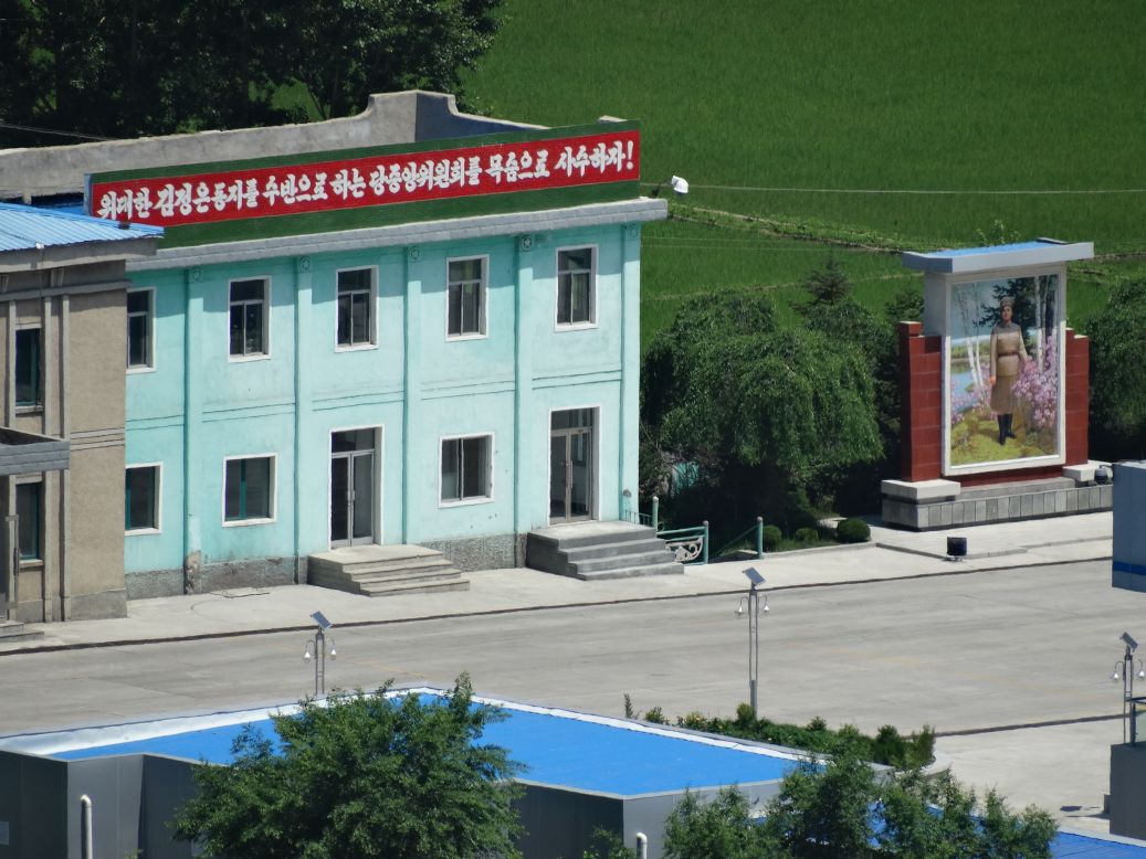
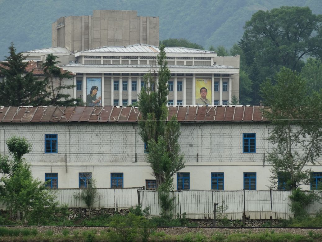
Hoeryong is home to Kim Il Sung's first wife and Kim Jong Il's mother, Kim Jong Suk. Unlike most other cities in North Korea which are dominated by statues of the great leaders Kim Il Sung and Kim Jong Il, in Hoeryong it is Kim Jong Suk's likeness that adorns the city's statues, public squares, and murals. You can see her very large portrait on the right.
-------------------------------------------
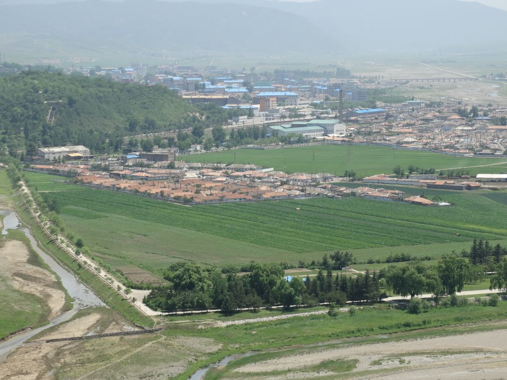
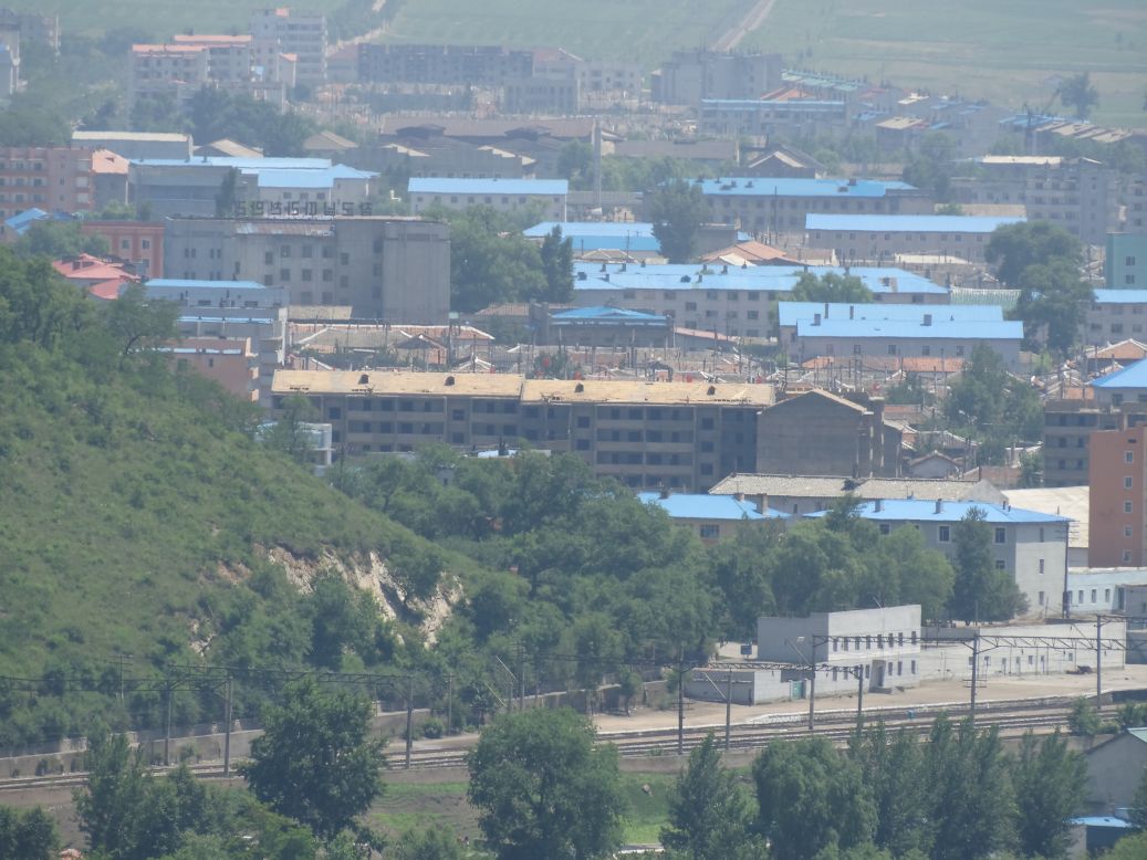
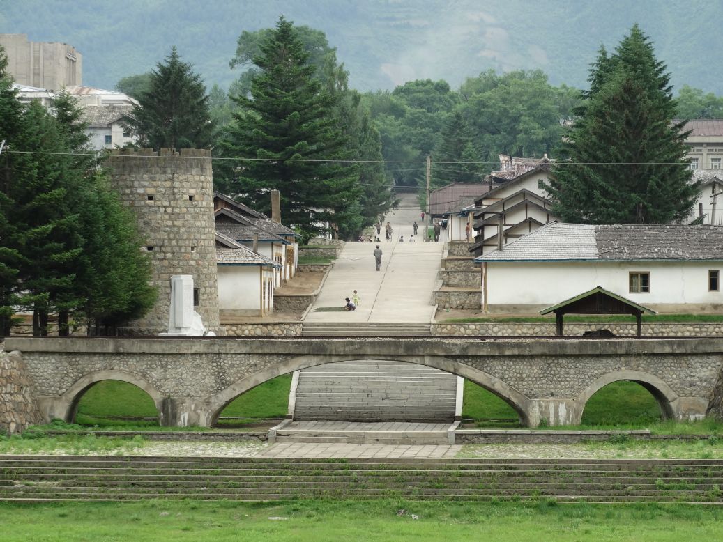
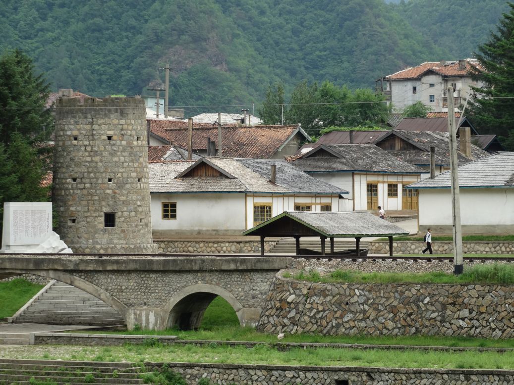
A few snapshots of the North Korean city of Hoeryong taken from across the river in China.

-------------------------------------------
Early morning stroll along the riverside of Changbai Village, within a stone's throw of the North Korean city of Hyesan.


-------------------------------------------
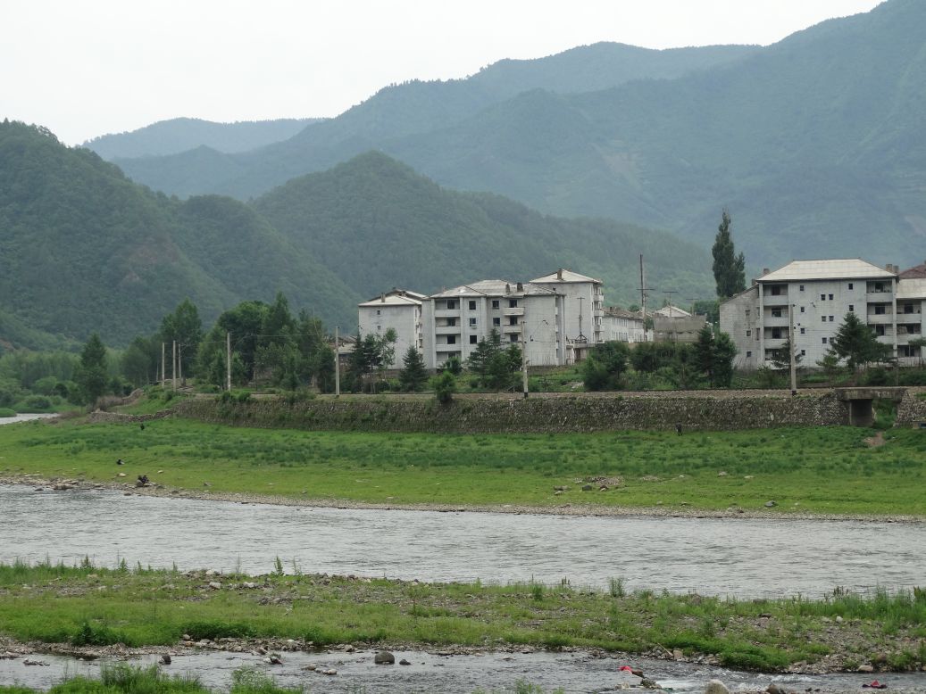
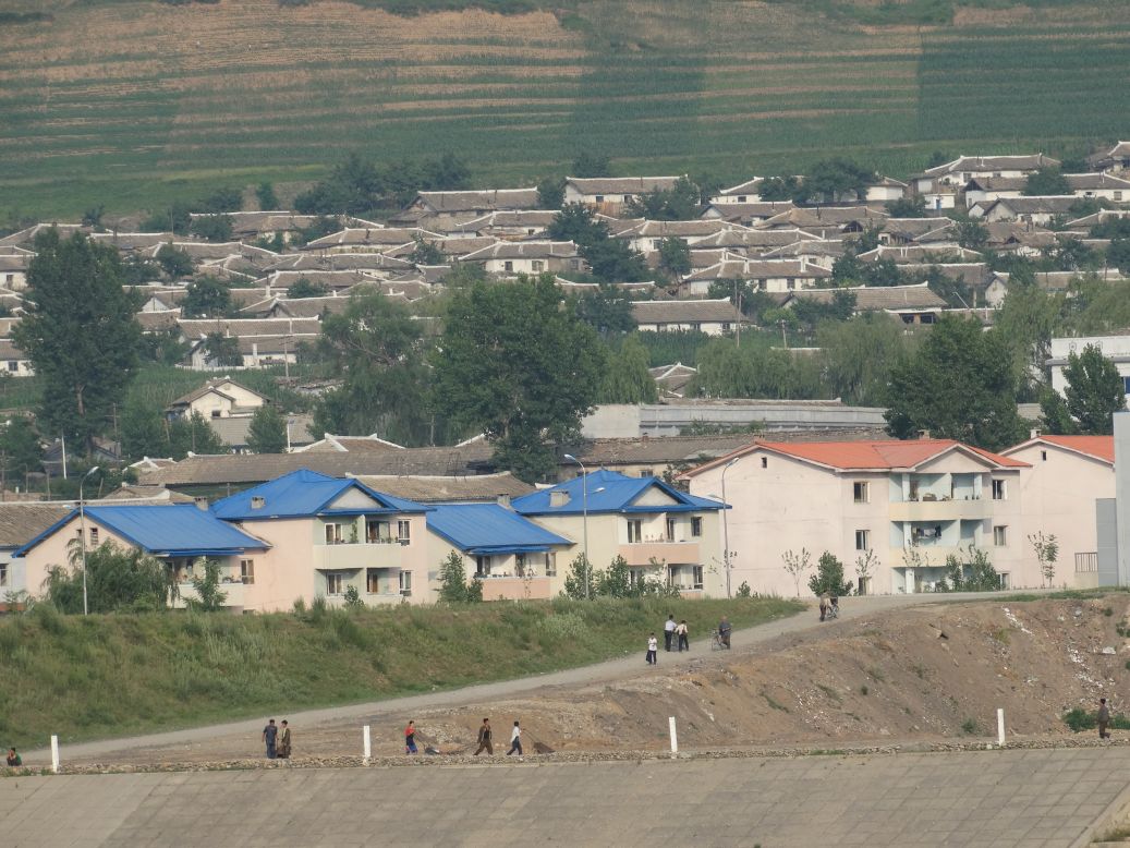
Kim Jong Suk Village, one of the more charming North Korean towns I enjoyed observing and photographing from across the river.


-------------------------------------------
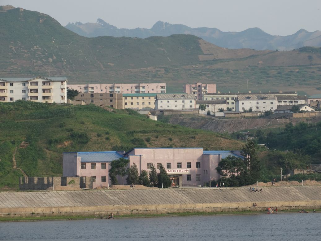
Across the Yalu River from the North Korean village of Kim Hyong Jik.
-------------------------------------------
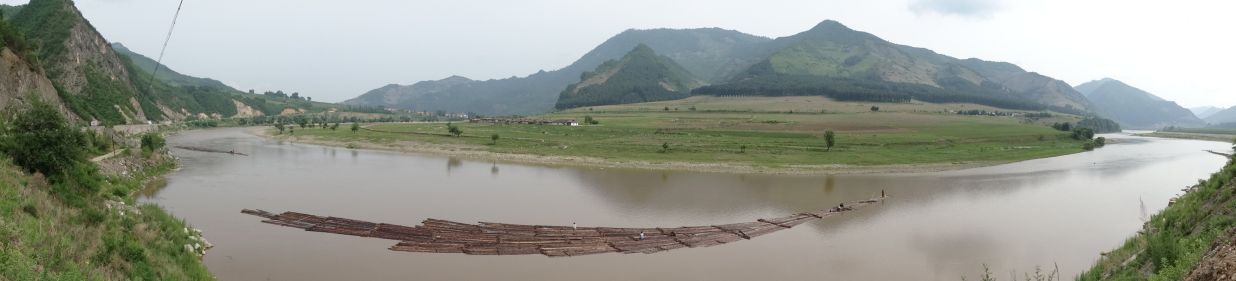
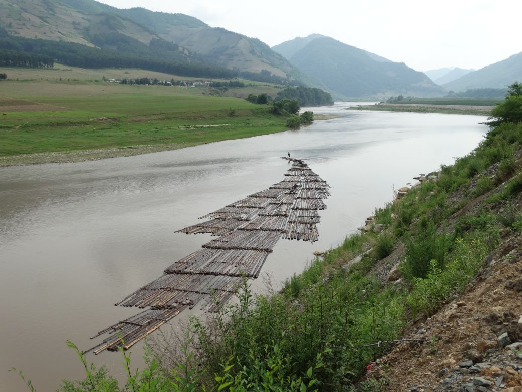
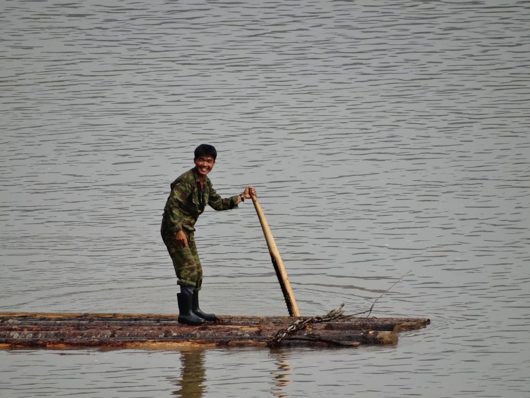
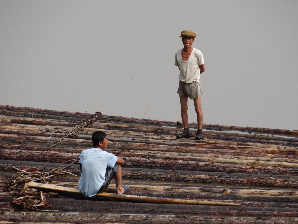
One of the most serene images on the trip, North Korean loggers floating down the Yalu River. Despite the border signs saying "no shouting at Korea," we had a good time with these guys as we shouted greetings at each other and they lobbed every English word they had ever heard in my direction. Most of the 'conversation' made little sense, but it was a fun interaction nonetheless.

-------------------------------------------
Singing North Korean waitresses and dog meat served in a North Korean-owned restaurant in Baishan.

-------------------------------------------
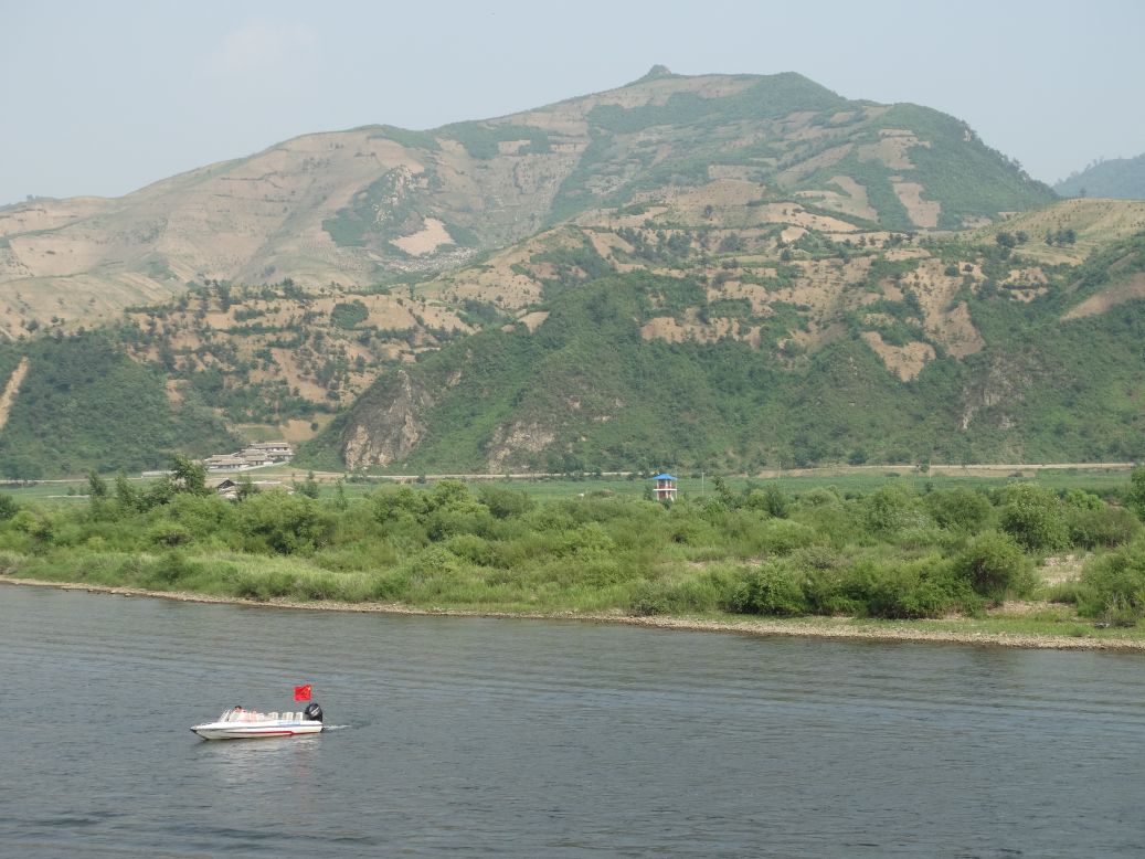
Chinese speedboats take tourists along the river for closeup views of North Korea from the city of Ji'an. Not much on this stretch of the river but a small village and a North Korean guard tower. We would find out later that the Chinese & North Korean governments have an agreement to keep tourists away from the main areas of the city.
-------------------------------------------
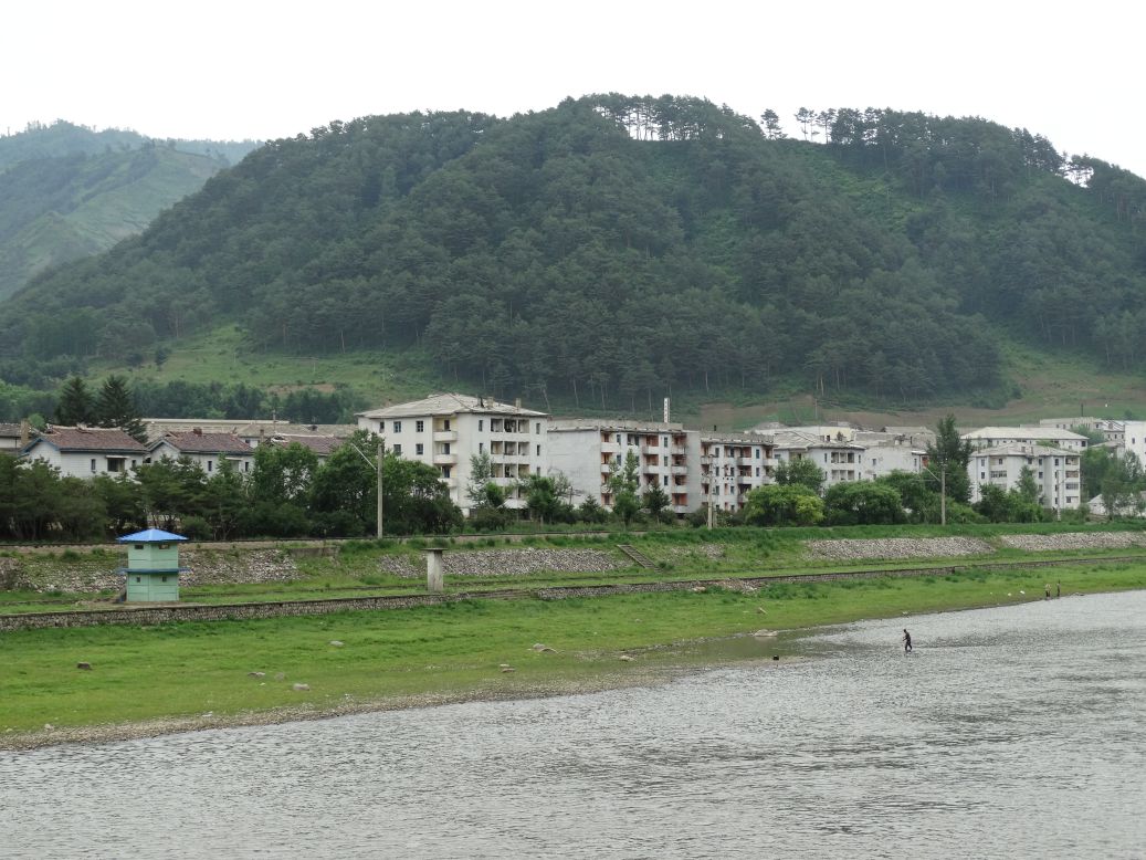
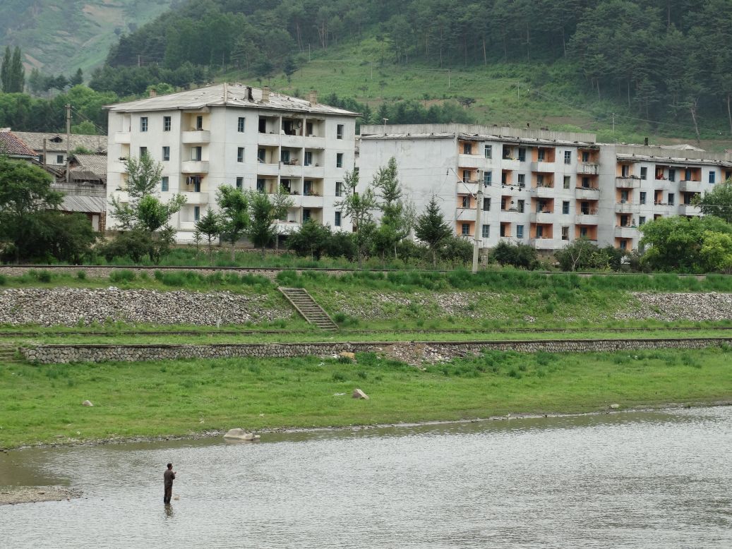
Rare photographs of the North Korean city of Manpo in the notoriously reclusive province of Jagang. Tourists are not welcome here, and photographers less so. Chinese military checkpoints prevent nonresidents from using the roads to the riverside, so we had to walk quite some distance through farmlands to get these shots across the Yalu River.


-------------------------------------------
The Ji'an riverbank is awash in colorful neon at night. Across the river, North Korea is black. It's as if the whole country has disappeared into nothing...

