South Korea/North Korea Border
(from South Korea)


A visit to the world's most heavily-fortified border is a haunting experience that stays with the visitor long after leaving. Touring the DMZ from the South consists of equal parts history and hysterical paranoia; indeed, those who have been fortunate enough to visit this area from both Koreas are always mystified with the endless parade of restrictions on the tours from the South. Tourists from the North face no dress code and are actually encouraged to take as many pictures as possible from a variety of different angles. Unfortunately photography is prohibited in most of the border area if approached from the South, so the pictures below are a combination of two different trips there and offer only the briefest of glimpses of this most unusual place.
---------------------------------------
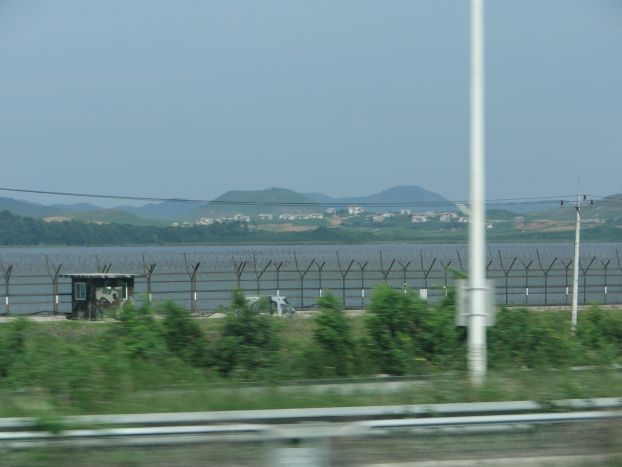
Seoul lies uneasily close to the North, which regularly threatens to turn South Korea's capital city into a "sea of fire." As soon as one leaves Seoul heading north, the city's coastal defenses are hard to miss. At one point the two Koreas come shockingly close to each other in the narrows of a river, as can be seen in the shot below taken from our moving tour bus. The buildings in the background here are in North Korea. In some places the two countries seem to almost merge together on the horizon so it becomes difficult to tell which Korea one is viewing at any given time. Our guide offered the following helpful hint in cases like this: it's as simple as observing whether or not there are trees on the hills. If there are, then you are looking at South Korea. The hills in the North are barren of trees because the much poorer Northerners cut them down for heating purposes years ago.
---------------------------------------
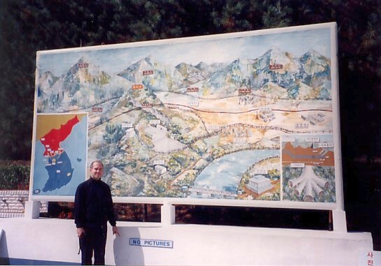
Display sign showing some of the North Korean invasion tunnels that the South Korean military has discovered over the years. Some have been frighteningly advanced in design and construction, including one that featured a railroad track for fast transport of invading troops and armaments underground.
---------------------------------------
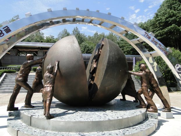
Symbolic sculpture at the Third Tunnel site showing the two Koreas being pushed together in unity. Pro-unification artwork and sculptures are found on both sides of the DMZ, but more so in the North.
---------------------------------------
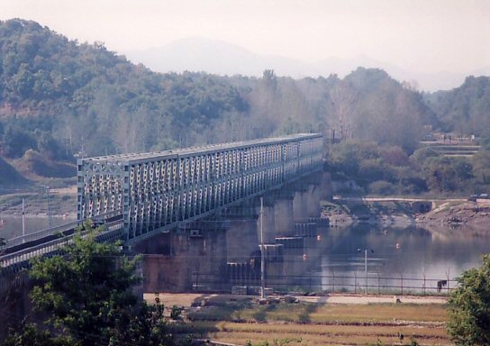
Freedom Bridge and rail, among the only links connecting South Korea to the Demilitarized Zone between the two Koreas.
---------------------------------------
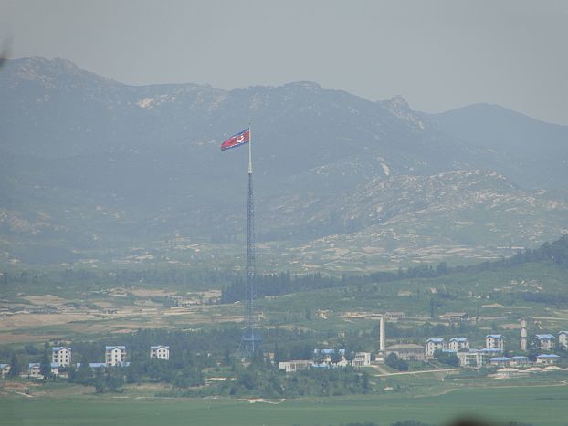
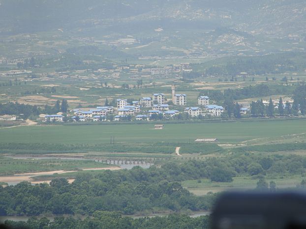
Some shots of North Korea from the Dora Observatory. In one of the more ridiculous attempts to restrict picture taking, the South Korean military has a row of binoculars set up for easy viewing of the North -- for a fee -- while those with cameras must stand behind and try to take pictures from approximately 10 feet back. The row of binoculars, and the tourists using them, form an effective blockade that makes photography all but impossible. Nonetheless, I managed to get a couple clear shots of what the South calls the North's "Propaganda Village" by holding the camera high over my head and getting lucky.
---------------------------------------
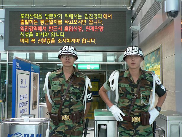
Two South Korean soldiers patrol Dorasan train station, the farthest north one can travel in South Korea by train. "Not the last station for the South, but the first station toward the North," says a hopeful sign next door.
---------------------------------------
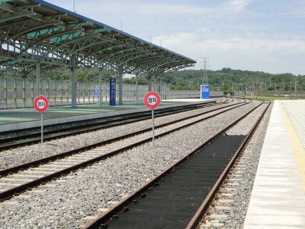
The end of the line for the train. Beyond the red stop signs lies North Korea.
---------------------------------------
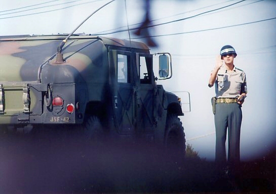
Tour groups are allowed inside the DMZ only with heavy military escort.
Here, a South Korean soldier motions our caravan to stop at a military checkpoint.
---------------------------------------
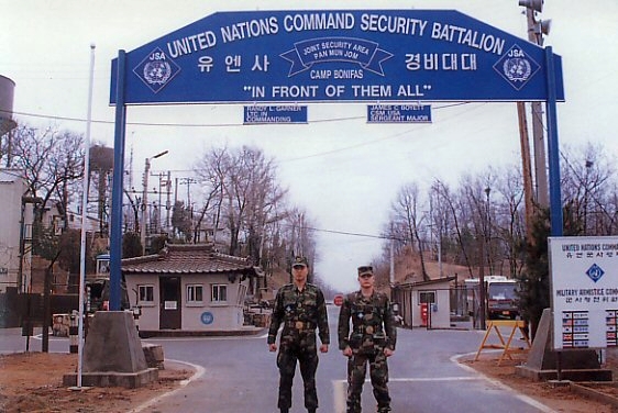
Getting closer to the Joint Security Area in the DMZ.
One quickly sees (and hears) the motto of military personnel stationed here: "In Front of Them All"
---------------------------------------
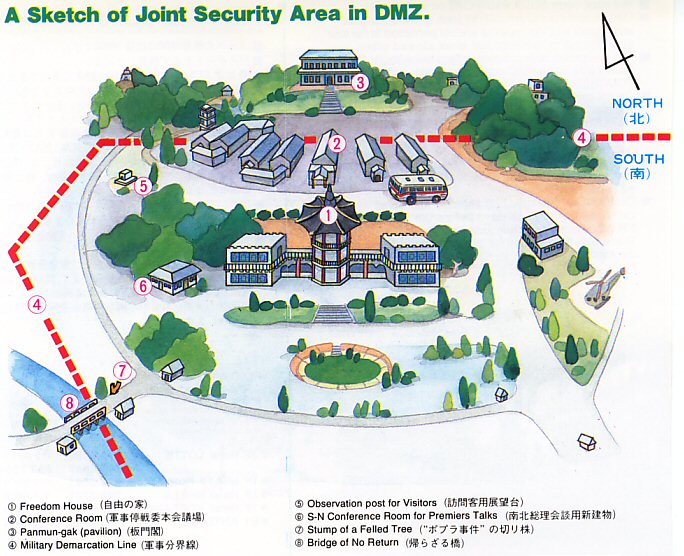
A helpful map showing the major buildings in the Joint Security Area visited by tourists from the South. I have included some of the location numbers of important sites in the photographs below for easy reference.
---------------------------------------
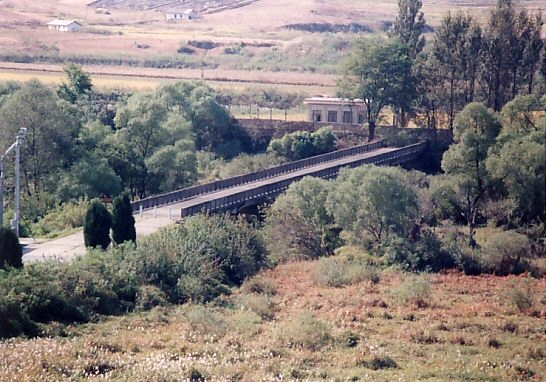
The Bridge of No Return, site of a massive prisoner exchange after the Korean War (#8 on the map above). South Korea is in the foreground in this shot. The actual DMZ border sign stands in front of the white poles on the near side of the bridge; the bridge itself and the buildings visible beyond are in North Korean territory.
---------------------------------------
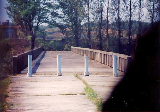
Pulling up alongside the bridge, as close to North Korea as one can get while riding in a tour bus (this photograph taken at position #7 on the above map). North Korean territory officially starts behind the white pole barricade. At the end of the Korean War, prisoners from both sides were brought here and given the opportunity to choose which Korea to cross to. Once the decision was made there was no turning back, giving rise to the name Bridge of No Return.
---------------------------------------
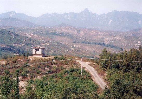
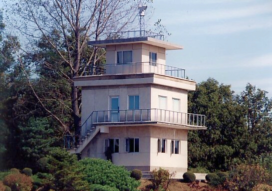
North Korean guard posts dot the hillsides in seemingly every direction.
---------------------------------------
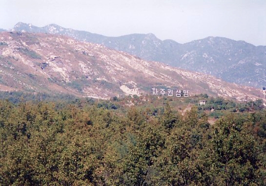
In the past, both Koreas used to erect giant propaganda messages from hillsides directed at personnel on the other side of the border. Loud martial music blared from enormous speakers nearby, audible across the border as well. These things have since been dismantled, so I include this picture for nostalgia's sake. Besides, this practice can always rear its ugly head again in the future if relations between the two countries continue to deteriorate. Most messages testify to the host nation's superior way of life. The North Korea propaganda sign pictured here says, simply, "Freedom and Independence," a not-so-subtle jab at the fact that South Korea still hosts foreign military troops on its soil.
---------------------------------------
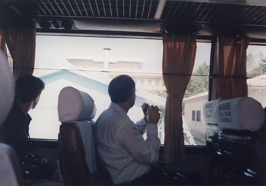
Our tour bus literally drives right up to the dividing line between the two Koreas. Here is shot of me gazing in amazement out the window to my left at the blue United Nations Military Armistice Commission buildings that straddle the actual border (the light-colored concrete building just visible behind them is in North Korea, #3 on the above map).
---------------------------------------
A couple of quick shots taken out the bus window as we slowly come to a stop next to the border. First, South Korean soldiers salute and take up positions as we arrive. A North Korean watchtower is visible in the upper right, strategically located to be able to look down with an unobstructed view on this entire area.
 Next, a blurry shot, but I like it anyway because the blur gives it even more of an eerie effect. As our bus grinds to a halt, a North Korean soldier pauses in the distance and stares. A South Korean soldier warily watches from the bottom right.
---------------------------------------
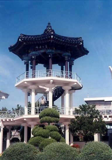
Freedom House, South Korea, just a few feet away from the formal North Korea/South Korea border. Climbing the stairs provides an excellent view of the border area. (#1 on the map above)
---------------------------------------
View from the pavilion staircase. I love the imagery in this shot, the tough "at the ready" martial arts stance of the South Korean guard mirroring that of the statue with its raised fist. Both face the North Korean border & soldiers just a few feet away.

---------------------------------------
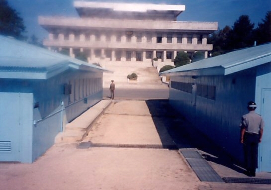
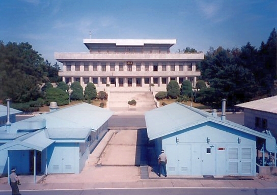
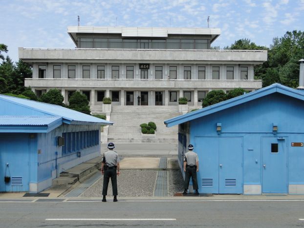
The view across the DMZ from the top of the Freedom House pavilion. Panmun-gak, the large concrete building, is in North Korea (#3 on above map). The buildings painted in United Nations blue straddle the actual border between the two countries (#2 on above map). The exact border is the raised concrete strip that runs between the blue buildings at the midpoint, visible in this picture. The half of the buildings in the foreground is South Korea; the back half is inside North Korea. The border cuts the buildings into two equal parts, and it is here where Korean delegations from both sides of the border conduct negotiations.
---------------------------------------
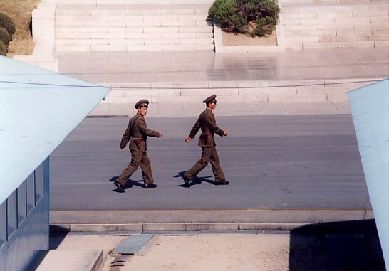
Two North Korean soldiers on the move as we arrive.
---------------------------------------
Under watchful eyes from several surrounding North Korean guard towers (North Korean guards watching us are visible in both pictures below).

---------------------------------------
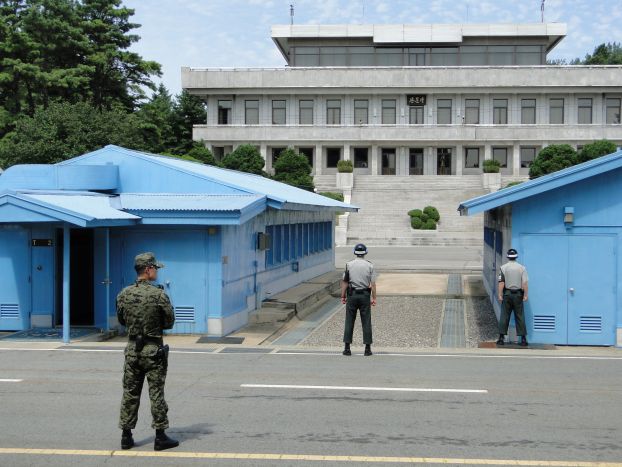
We slowly make our way closer to the blue Military Armistice Buildings that straddle the border. South Korean guards take up positions in front of us. You can see a North Korean guard watching us through his binoculars at the top of the steps of the large concrete pavilion in the background.
---------------------------------------
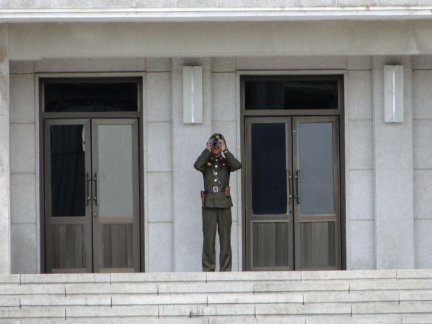
Zooming in on the North Korean guard who is zooming in on us.
---------------------------------------
A few quick snapshots in succession as the South Korean soldiers take up positions and get ready to escort us to the actual borderline.
---------------------------------------
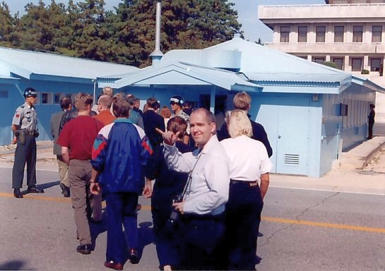
Finally going inside the border building (#2 on the map) to symbolically cross the inter-Korea border.
---------------------------------------
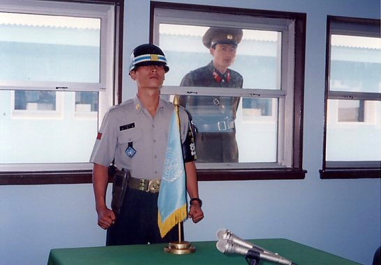
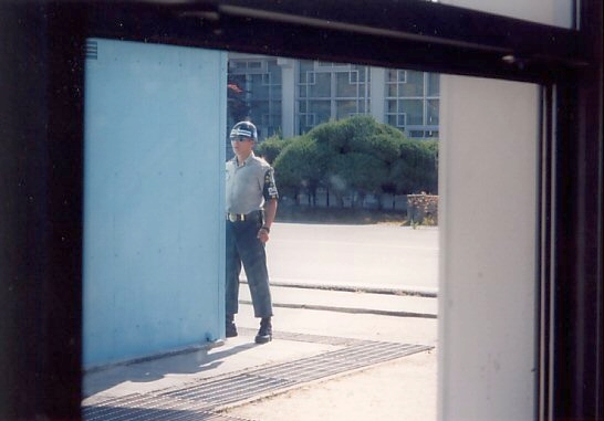
Inside, a study in contrasts. In what has to be one of the most surreal travel experiences imaginable, South Korean soldiers accompany us into the structure itself while North Korean military personnel watch us through the windows from outside -- literally inches away.

---------------------------------------
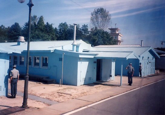
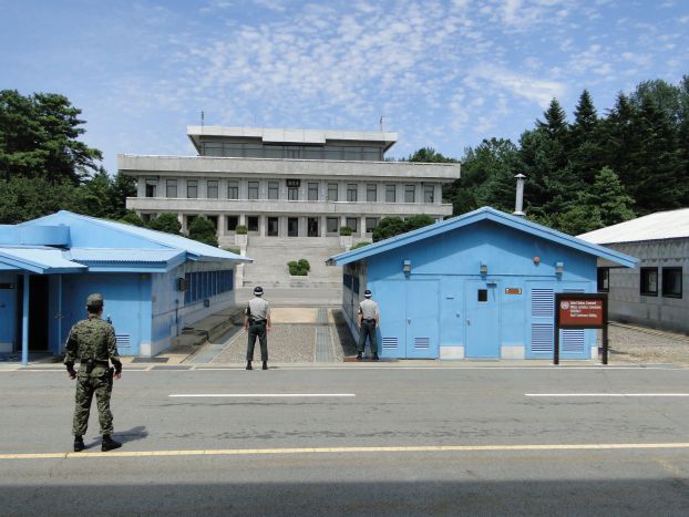
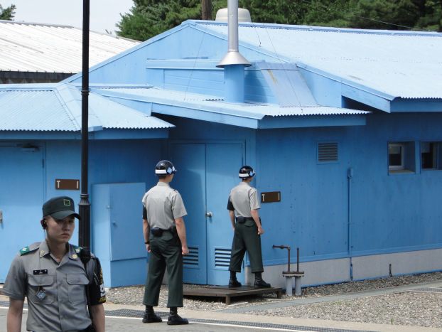
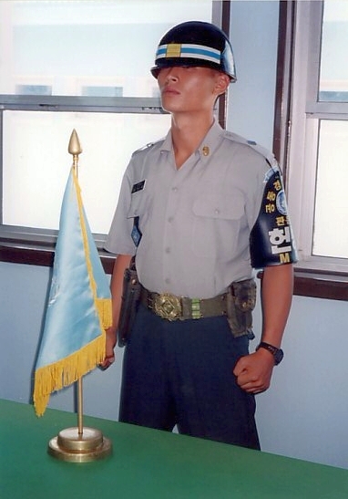
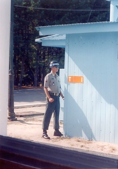
Outside, South Korean soldiers stand on guard to defend us, and to look as menacingly as possible to their North Korean counterparts just a few feet away.

---------------------------------------
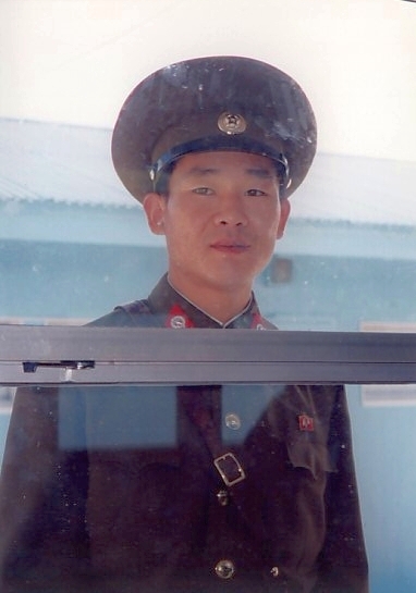
On the left, a picture of me in the Democratic People's Republic of Korea. I am standing next to the half of the table that lies within North Korean territory (yes, even the table is divided between the two countries. The line of microphones is the official border!). The North Korean soldier seems rather taken with my fancy camera equipment.
On the right the same soldier, literally two feet away. Only the thin glass of the windows separated us, yet our two worlds could not have been farther apart. In the past it has been reported that these soldiers will sometimes strike the glass and yell just to make noise and startle people, but today they seemed content enough just to watch us.

---------------------------------------
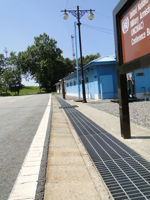
The zeal to control us and what we could photograph extended right up until the moment we left the area. We were ordered to turn our cameras off and fall together in two rows to walk away from the border. We were also told not to look back, which seemed unnecessary overkill. Since pictures were no longer permitted, I snapped this shot blindly from my side hoping to catch something interesting on my way out. You can just make out a South Korean soldier under the sign along the right margin, still in his vigilant tae kwon do pose as he faces north.
---------------------------------------
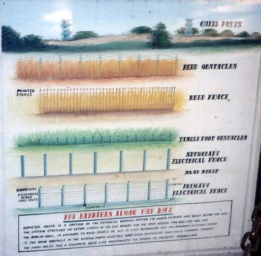
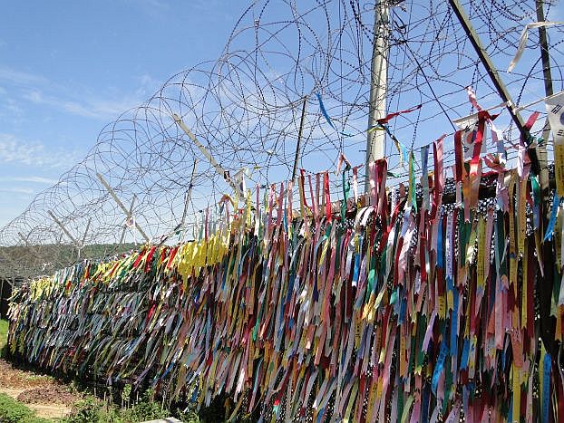
Back a ways from the border and a bit deeper in South Korean territory, time to quietly reflect on a sign details the extensive six layers (!) of fencing and obstacles that the North Koreans have built along the entire length of the DMZ to keep their people from escaping. Guard posts, reed obstacles, a reed fence with pointed spikes, tanglefoot obstacles, a secondary electrical fence, and a primary electrical fence all stand in the way of the North Korean people and the West.